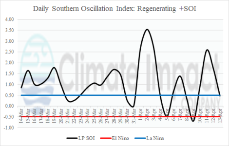
Weak or non-existent trade winds to up-well cool waters are starting to regenerate as the southern oscillation index (SOI) shifts to a mostly positive phase during the past 30 days.
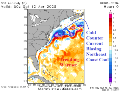
A cold north to northeast wind has brought rain and snow to New England this weekend thanks to an offshore storm system made colder by the frigid counter-current to the warm Gulf Stream east and southeast of New England.
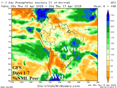
While the U.S. AG Belt may receive some patchy wet weather during the medium range, the South America forecast is trending wetter. Rainfall increases in both Argentina and Brazil in the 2-week outlook, possibly too wet.
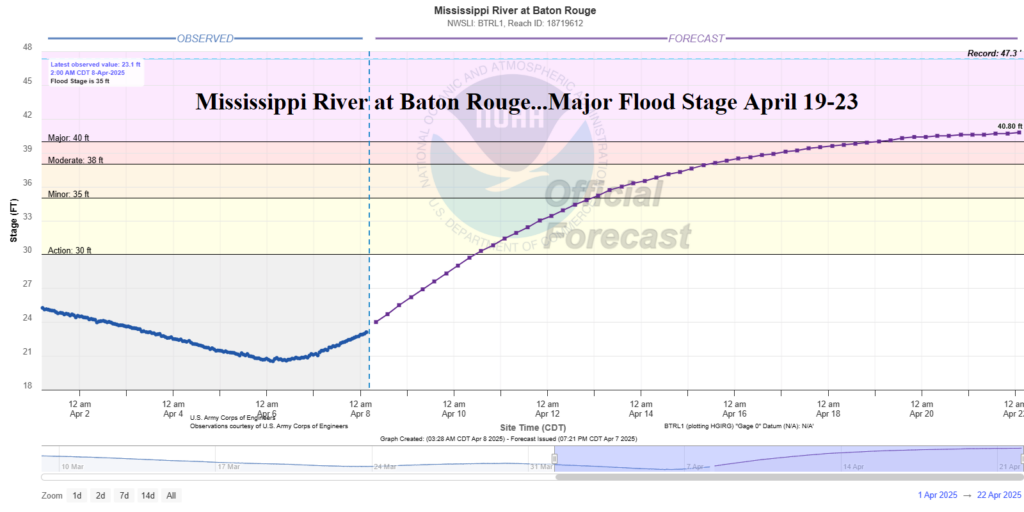
The high water will flow south through the Mississippi River through mid-month with water levels reaching moderate stage to near major flood stage based on current long-range forecasts. One exception is the Mississippi River at Baton Rouge forecast to shift firmly into the major flood stage beginning April 19th.
