News
01/16/2024, 2:25 pm EST

A Check on Europe HDD Forecasts

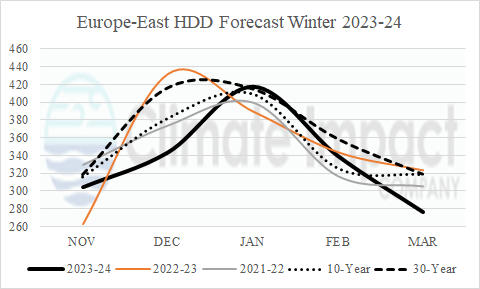
Despite the presence of arctic air across Eurasia during the first half of the winter season, most Central and South Europe cities observed a warm start to winter shifting colder in January. The chilly first half of January reverses warmer in the last third of the month forecast.
01/14/2024, 7:54 pm EST

Madden Julian Oscillation To Intensify

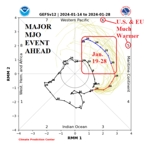
NOAA/CPC indicates an emerging and very intense convection phase of the Madden Julian oscillation (MJO) pushing across Maritime Continent over the next week or so and into the tropical West Pacific (phase_6) by January 23-24. During MJO P5 and P6 the mid-latitude Pacific jet stream strengthens and increases mild maritime influence on the North America and Europe climate.
01/12/2024, 9:00 am EST

All 50 States Have Weather Hazards; Northeast U.S. Snowstorm Next Tuesday

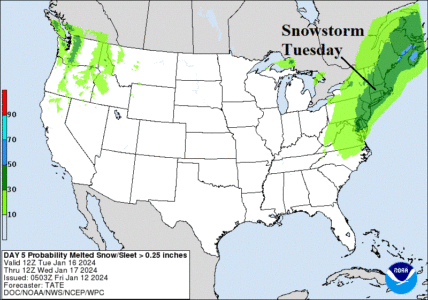
A rare occurrence! All 50 states have weather watch, warning, or advisories in effect. Another heavy rain/high wind event into the East heading into the weekend. However, by next Tuesday, the Northeast U.S. Corridor is looking at a moderate snowstorm including coastal areas.
01/11/2024, 12:43 pm EST

Shock Cold Next Week and Following Week Based on Today’s 12Z GFS

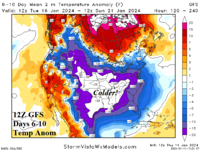
The 12Z GFS projects a cold medium-range forecast that is stronger and longer than the FEB-21 “Uri” event. Support for the cold is singularly generated by the GFS model. The 6-10-day forecast frigid forecast trends much colder into Texas. The 11-15-day forecast is expected to moderate due to mild Pacific influence. However, the GFS doubts that possibility and generates a much colder 11-15-day forecast at midday. The 12Z GFS generates a whopping 281.5 HDD for Jan. 19-25 which is about 10 HDD colder than the “Uri” event Feb. 12-18, 2021.