11/03/2025, 5:10 am EST
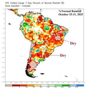
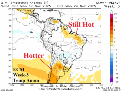
After a drier than normal month of October for much of Brazil, a wetter risk is presented in November for some (not all) parts of Brazil as a strong negative Antarctic oscillation fades and transient Madden Julian oscillation shifts eastward.