Explaining the Extreme Rainfall Events in Eastern Australia
10/16/2022, 10:15 am EDT
Updating The North Pacific “Warm Blob” and Explaining Optimum Climate Normal
10/26/2022, 5:00 am EDT
Fig. 1: Daily global SSTA analysis and annotated regions identifying climate influence areas.
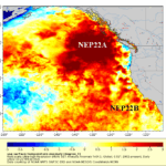
Discussion: Most climate influencing SSTA regions are warm during early Q4/2022 (Fig. 1). Included are typical (of the past 10 years) mid-latitude marine heat waves (MHW) also known as “warm blobs”. The most famous “warm blobs” are in the Northeast Pacific (NEP22A and NEP22B) and each has intensified during recent weeks, especially of the West Coast of Canada. The tendency for western mid-latitude ocean basins vividly remains east of China and southeast of Canada. An immense MHW continues across the central/west Mediterranean Sea. In the southern hemisphere, MHW persist east of Australia and east of Argentina plus off the South Coast of Africa. Notice the regions of climate influence are immense in each hemisphere and added to negative Indian Ocean Dipole (-IOD) and La Nina).
The correlation of the SSTA regions to prevailing northern and southern hemisphere climate is profound. In the northern hemisphere, we begin with MHW NEP22A and NEP22B and the correlating intense upper-level high-pressure ridge emerging just downwind across West Canada and the Northwest U.S. (Fig. 2). MHW inspired upper-level high-pressure ridge areas are also located on the Dateline in the North Pacific and northwest North Atlantic basin. The ridge areas came first! To compensate for the ridge areas, an upper trough has emerged northeast of Hawaii and on the U.S. East Coast.
The Mediterranean Sea MHW has sustained an upper-level high-pressure ridge during October across Southwest Europe while warm SSTA off the North Coast of Russia is well-correlated to a Central Russia ridge.
In the southern hemisphere, MHW-inspired upper-level high-pressure ridge areas are vividly on display during October east of New Zealand and either side of Argentina (Fig. 3). The New Zealand ridge which also stretches to the south of Australia is compensated for by a wet upper-level low-pressure trough in Eastern Australia.
Before correlating the regional SSTA to the most likely November 2022 upper air pattern for both hemispheres using a constructed analog, a quick review of global soil moisture conditions is provided. In the U.S., the 2022 drought pattern has become impressive still featuring long-term drought in the West U.S. and an intensifying and widening character so far in October across the central U.S. (Fig. 4). There is no question that a leading catalyst to the expanding 2022 drought pattern in the U.S. is related to the warm SSTA patterns in the North Pacific and North Atlantic. Similarly, the Mediterranean Sea MHW inspired the ongoing Europe drought (Fig. 5). Warm SSTA off the East Asia Coast inspired speedy drought evolution in China (Fig. 6). In South America, warm SSTA either side of Argentina has contributed to a new drought for that region (Fig. 7). The New Zealand MWH caused a persistent ridge to continue and compensated for a wet trough sustaining historical wet soils in East Australia (Fig. 8).
The updated SSTA-based constructed analog forecast projecting the prevailing upper air pattern for the northern and southern hemisphere during November 2022 is very instructive as to where high impact weather/climate events will occur. First, in the northern hemisphere (Fig. 9), the upper trough northeast of Hawaii and to the north of Hawaii in October will phase and produce a strong Gulf of Alaska (GOA) low-pressure area for November. Significant wet weather is likely on the Canadian West Coast while snows pile in Alaska. To compensate for the trough, a full-latitude upper ridge is projected across Central North America likely to sustain and intensify the widespread drought. The October Mid-Atlantic trough shifts offshore keeping the East temperate and blocking most of the Ventral U.S. warmth from reaching the East Coast.
In Eurasia, the Mediterranean Sea MHW-inspired ridge shifts eastward toward the Middle East and a broad upper-level low-pressure trough is introduced to Northwest and Southwest Europe. Colder wind moving across the open ocean north of Russia creates ocean-effect snow cover causing the atmosphere aloft to cool and evolution of an upper trough in Central Russia.
In the southern hemisphere, the New Zealand high-pressure ridge continues and the compensating wet trough in Southeast Australia producing more heavy rain continues (Fig. 10). The warm SSTA either side of Argentina maintain a high-pressure presence promoting drought (for Argentina) during November. Also note that the upper trough soaking Southeast Brazil in October shifts offshore likely causing a drier pattern change.
Conclusion: Regional SSTA in the middle latitudes continue to have a profound influence on climate as Q4/2022 has started and this influence will certainly continue in November 2022. The SSTA-based constructed analog indicates high impact climate zones for November include an amplifying dry climate producing upper-level high-pressure ridge over central North America, an eastward shift to the Middle East (from Southwest Europe) of the Mediterranean Sea MHW-inspired upper ridge that caused the 2022 Europe drought pattern. In South America, warm SSTA either side of Argentina correlate to strengthening drought while the wet trough across Southeast Brazil during the past few months weakens and moves east causing a drier reversal. The influence of the New Zealand MHW is to soak East Australia and that regime continues during November.

Fig. 2: Correlating regional SSTA to the October 2022 (so far) upper air pattern in the northern hemisphere.

Fig. 3: Correlating regional SSTA to the October 2022 (so far) upper air pattern in the southern hemisphere.


Fig. 4-8: Current soil moisture anomalies across the U.S., Europe, Asia, South America, and Australia.

Fig. 9: Based on a constructed analog utilizing past similar early-to-middle Q4 SSTA a projected November 2022 upper air forecast for the northern hemisphere.

Fig. 10: Based on a constructed analog utilizing past similar early-to-middle Q4 SSTA a projected November 2022 upper air forecast for the southern hemisphere.
