Despite Developing La Nina, Eastern Australia Is Dry/Hot Late-DEC to Mid-JAN
12/17/2024, 4:06 am EST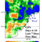
Brazil Wet Bias GFS/ECM Forecasts; Machine Learning Outlooks Gain Visibility
12/22/2024, 11:11 am EST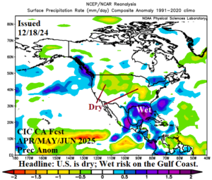
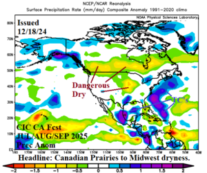
Fig. 1-2: The Climate Impact Company constructed analog precipitation anomaly forecast for Q2 and Q3 of 2025.
Discussion: Yesterday’s year ahead climate forecast for North America reveals a dry climate pattern setting up across the northwest Great Plains to the Ohio Valley during APR/MAY/JUN 2025 expanding northward across the Canadian Prairies during JUL/AUG/SEP 2025 (Fig. 1-2). The dry pattern is accompanied by anomalous heat and implies potential for a large drought developing during the 2025 warm season.
La Nina is here! The daily Nino34 SSTA has plummeted to -0.87C (Fig. 3), a 30-day change of -0.65C! The upper ocean heat anomalies east of the Dateline have cooled and indicate increasing fuel for La Nina (Fig. 4). NOAA should issue a La Nina onset notice by Jan. 1.
An interesting rainfall forecast across Brazil is indicated. The recent rainfall pattern has emphasized resistance to wet weather for much of central and eastern portions of Brazil while heavy rain has centered on Paraguay and Northern Argentina. Recent 15-day forecasts have shifted the wet weather northward with expansion across central and eastern Brazil, areas where dryness has prevailed during early meteorological summer. The most reliable model for rainfall forecasts during recent weeks is the GFS which keeps most of the rainfall in the latest 15-day outlook in Southern Brazil (Fig. 5) while the usually reliable ECM ENS is soaking wet for central and eastern Brazil (Fig. 6). The ECM ENS has developed a strong wet bias to their forecasts in recent weeks across Brazil. To settle the argument, the updated and improved AI Graph Cast ECM ENS shifts the wet weather northward, similar with ECM ENS, but with less amplitude and drier forecasts either side of the wet zone (Fig. 7).
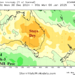
The Australia rainfall picture is different. Transient heavy rainfall episodes are indicated by AI Graph Cast ECM ENS! Up to 5 in. of rain is possible on the northeast coast of Queensland for the weekend (Fig. 8). In the 6-10-day period, heavy rain area appears on the Northwest Coast (Fig. 9) and expands inland to the central continent in the 11-15-day period (Fig. 10). While wet weather forecasts increase amplitude, southwest and southeast Australia miss the rain and stay dry.
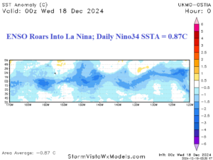
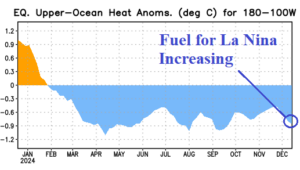
Fig. 3-4: The daily Nino34 SSTA and upper ocean heat anomalies east of the Dateline.
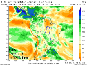
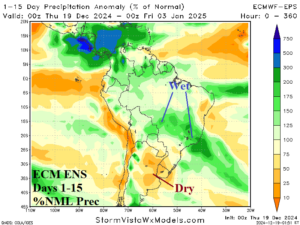
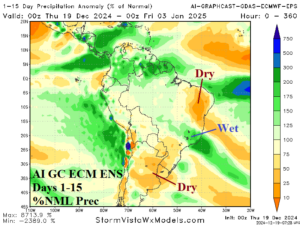
Fig. 5-7: 15-day percent of normal rainfall forecasts across South America from GFS, ECM, ENS, and AI GC ECM ENS.
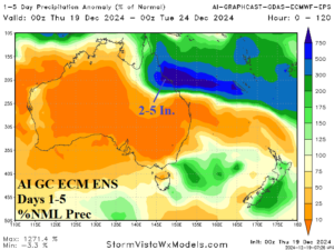
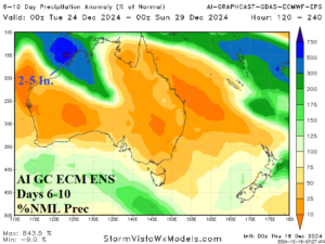
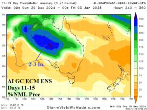
Fig. 8-10: The 15-day AI GC ECM ENS percent of normal rainfall forecast across Australia.

