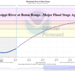
Major Flood Stage Mississippi River at Baton Rouge by April 19th
04/08/2025, 5:36 am EDT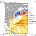
Influence of Cool (and Warm) SSTA on U.S. Climate
04/13/2025, 1:52 pm EDT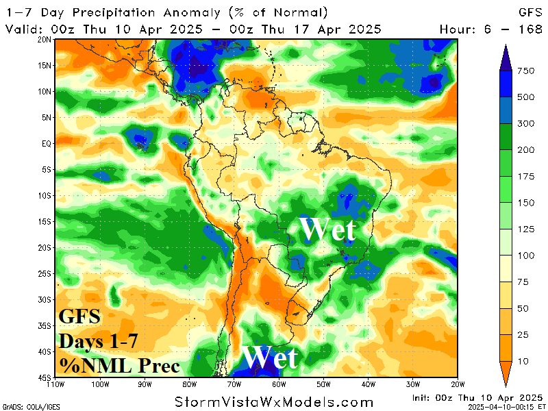
Highlight: Black Sea region chills through the weekend, patchy rains possible in U.S. AG Belt in the medium range, and South America trends wetter.

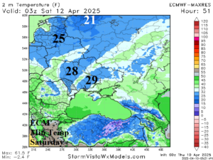
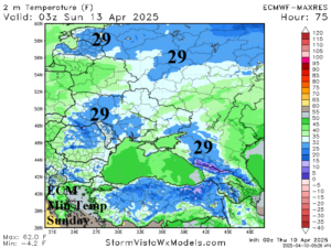
Fig. 1-4: ECM morning low temperature forecasts across the Black Sea region for today through Sunday.
Discussion: The cold wave across Eastern Europe to West and Southwest Russia continues through the weekend (Fig. 1-4) finally abating on Monday. The coldest of the next 4 mornings is Friday with mid 20’s (-4C) in Central Ukraine. The 15-day precipitation forecast is “mostly dry” according to GFS (Fig. 5) while ECM has some rain in far Southwest Russia. Overall, the precipitation forecast is trending drier. Despite some recent significant precipitation, the daily soil moisture anomalies analysis from NOAA indicates widespread worsening dry-to-drought conditions (Fig. 6).
Hints of an increasingly active and transient Madden Julian oscillation (MJO) entering the western tropical Pacific Ocean to encourage more Central U.S. rainfall is less likely based on overnight forecasts. ECM is quite dry while GFS indicates patchy significant rain (Fig. 7-8) but with no attachment to the subtropics (or tropics).
While the U.S. AG Belt may receive some patchy wet weather during the medium range, the South America forecast is trending wetter (Fig. 9-10). Rainfall increases in both Argentina and Brazil in the 2-week outlook, possibly too wet.
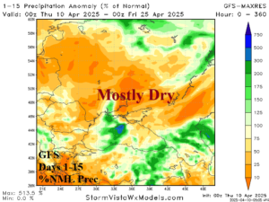
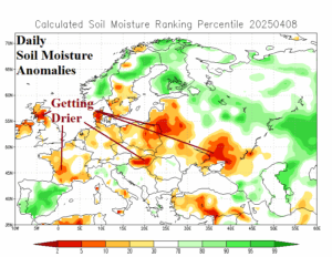
Fig. 5-6: The GFS 15-day percent of normal precipitation forecast and daily soil moisture anomaly analysis across the Black Sea and Europe regions.
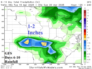
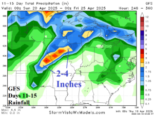
Fig. 7-8: The GFS medium range rainfall forecast across the U.S. AG Belt.

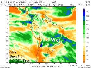
Fig. 9-10: The GFS 14-day percent of normal rainfall forecast across South America.