
Midwest/Mid-south/Gulf Coast Drought Worsening
09/28/2025, 12:21 pm EDT
Climate Impact Company North Atlantic Basin 10-Day Monitor
Issued: Monday September 29, 2025, 6:00AM EDT
Highlight: Direct effects from Imelda and Humberto stay offshore the East U.S.
High waves, undertow, and some beach erosion likely.
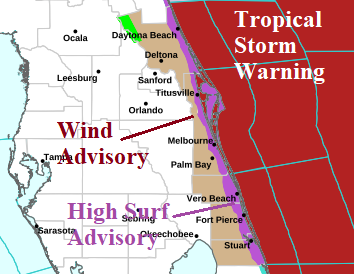
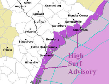
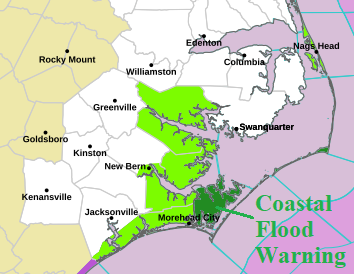
Fig. 1-3: Local NWS weather watch, warnings, and advisories associated with developing Tropical Storm Imelda.
Discussion: At 5AM EDT, Category-4 Major Hurricane Humberto was located about 375 miles south-southwest of Bermuda moving northwest at 14 mph with top wind near 130 mph and central pressure 933 MB. Humberto weakened slightly overnight. Humberto will maintain major hurricane intensity turning northward today and begin to lose intensity turning northeastward tomorrow afternoon well to the west of Bermuda and then accelerate east-northeastward gaining significant size mid-to-late week in the North Atlantic. Tropical storm conditions are likely in Bermuda. Humberto will produce significant seas, undertow, and some beach erosion on the U.S. East Coast this week.
At 5AM EDT, Tropical Storm Imelda was located about 295 miles southeast of Cape Canaveral, Florida. Imelda is moving north at 8 mph with top wind near 45 mph and central pressure 996 MB. Imelda moves through a marginally supportive environment today and tonight to allow strengthening. Humberto disrupts steering currents causing Imelda to turn sharply eastward tomorrow. As the upper westerlies capture Imelda, strengthening to a hurricane is possible. Imelda’s attendant high impact weather stays offshore Florida and the Southeast U.S. Coast although High Surf Advisories extend from Florida to the Carolinas. A Coastal Flood Warning is posted for parts or the North Carolina Coast.
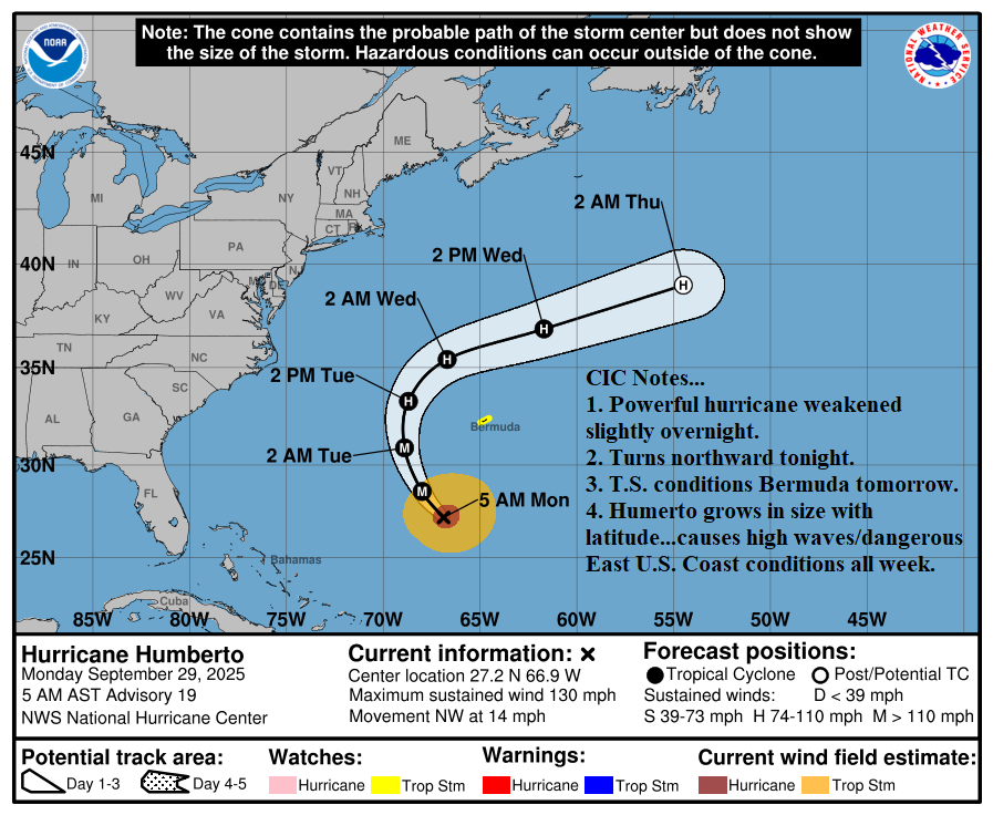
Fig. 4: NOAA/NHC 5-day forecast for Major Hurricane Humberto.
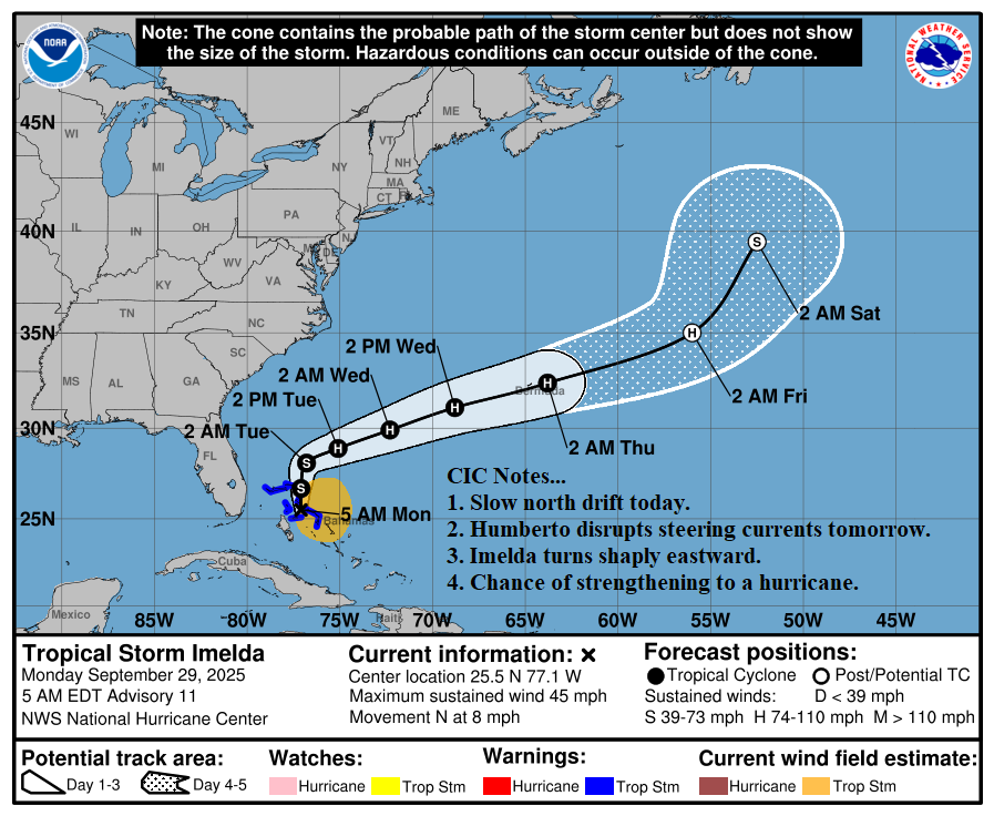
Fig. 5: NOAA/NHC 5-day forecast for Tropical Storm Imelda.