Heavy Rain Ahead Western Europe, Black Sea Turns Warmer
04/15/2025, 4:56 am EDT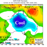
Cold Risk Introduced to Australia Winter Outlooks
04/23/2025, 5:23 am EDT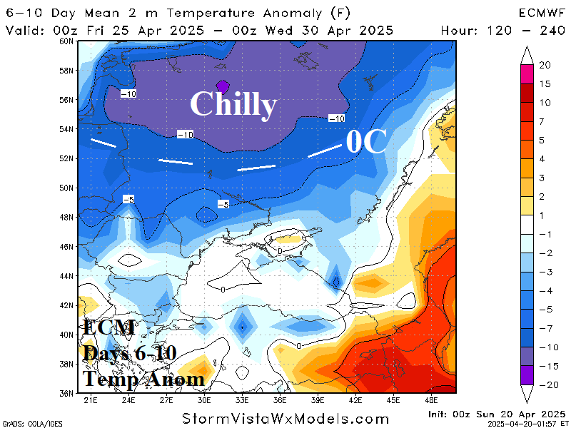
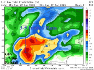
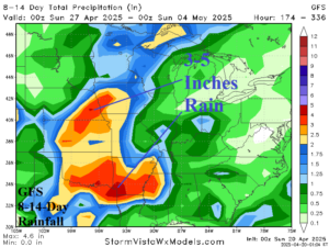
Fig. 1-2: The GFS 1-7-day and 8-14-day rainfall forecast across the U.S. AG Belt.
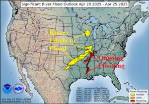
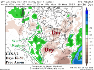
Fig. 3-4: The NOAA 5-day major river flood forecast and U.S. CFS V2 16-30-day rainfall anomaly forecast.
Discussion: The GFS forecasts persistent periods of heavy rain across Texas to the central Great Plains and into the Mid-south States through the next 2 weeks (Fig. 1-2). Rainfall forecast amount peaks in the 3-5 in. range from near Dallas to southwestern Missouri for the upcoming week and the southwest Great Plains plus Kansas/Nebraska in the 8-14-day period. Northeast Texas could receive as much as 10 inches of rain during the 2-week period. The current 5-day NOAA Major River Flood Forecast expands river flood risk westward from the Mississippi River (Fig. 3). In the extended range, the 16-30-day forecast indicates the wet weather pattern eases while shifting west to the western Great Plains and Continental Divide while the Ohio Valley to Gulf States turns drier (Fig. 4). Generally, warmer than normal conditions are forecast primarily due to higher-than-normal humidity and elevated night temperatures. The GFS and ECM indicate possible cooler weather into the Midwest U.S. and Ohio Valley in the 11-15-day period.
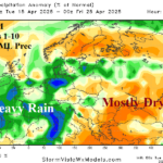
During the past week, much of the dry-to-drought soil moisture conditions across parts of Europe to Southwest Russia (Fig. 5) were drier than normal (Fig. 6) as drought worsened. The 2-week outlook indicates patchy wet weather visiting the Black Sea region. This week, showers stretch across Western Russia, miss Ukraine where dryness prevails, and ample rain reaches Southwest Russia (Fig. 7). The rain is slightly more expansive in the 8-14-day period in Southwest Russia while Ukraine is likely to stay dry (Fig. 8). Through the next 5 days, the region is exceptionally warm flipping much cooler in the 6-10-day period when the <0C line shifts south almost reaching Ukraine (Fig. 9-10).
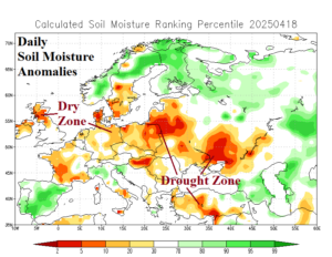
Fig. 5-6: The daily soil moisture anomalies analysis across Europe and 7-day percent of normal precipitation observations.
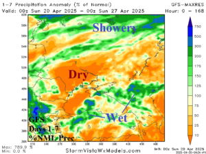
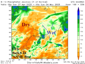
Fig. 7-8: The GFS 1-7-day and 8-14-day percent of normal rainfall forecast across the Black Sea region.
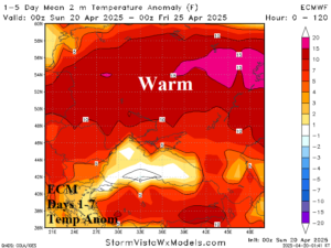
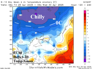
Fig. 9-10: The ECM 1-5-day and 6-10-day temperature anomaly forecast across the Black Sea region.