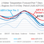
AIFS ENS Debuts at Number 1 Skill Scores U.S. Regions Days 6-10
07/13/2025, 9:27 am EDT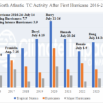
First North Atlantic Hurricanes 2016-24 and Following Activity
07/20/2025, 9:30 am EDT![]()
Climate Impact Company Daily Feature
Issued: Thursday, July 17, 2025
Highlight: Suddenly, Nino34 SSTA is cooling. Some models forecast La Nina ahead.
Discussion: During the past 1-2 weeks, the Nino34 SSTA has cooled by more than 0.4C to -0.28C in the latest daily analysis (Fig. 1). The La Nina threshold is -0.5C. Running parallel (and possibly related) to the Nino34 SSTA cooling is the vivid cool SSTA off the U.S. West Coast with that cooler water riding the California Ocean Current south and southwestward toward the tropics (Fig. 2). A classic cool phase Pacific decadal oscillation (-PDO) is apparent. Historically, -PDO and La Nina run together. Some operational models are forecasting Nino34 SSTA to cool below the La Nina threshold by October (Fig. 3). Seasonal hurricane forecast discussions have routinely mentioned the potential risk of weak La Nina for late season. Traditionally, the upper ocean heat signature across the eastern equatorial Pacific Ocean can foreshadow ENSO phase change ahead. Right now, a new cool pattern has developed off the northwest coast of South America while the remainder of the central and eastern equatorial subsurface is warm and shifted warmer during July (Fig. 4). So, while SSTA is showing some La Nina trend, the subsurface is reluctant as of mid-July. The southern oscillation index (SOI) identifies the atmospheric response to the equatorial Pacific SSTA regime. Generally, the SOI has been in a weak positive phase and shifting increasingly positive during the 15-day forecast (Fig. 5). The positive phase favors a La Nina bias. A potential ENSO shift toward La Nina has many climate implications including creating a more favorable North Atlantic basin environment to support hurricane activity and possibly a lengthier season.
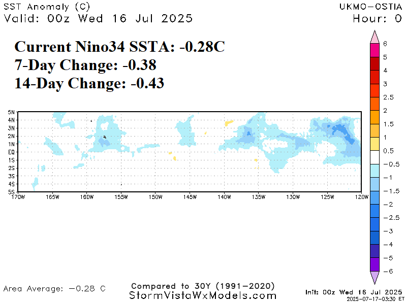
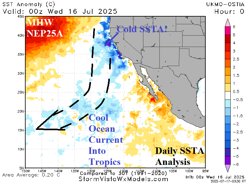
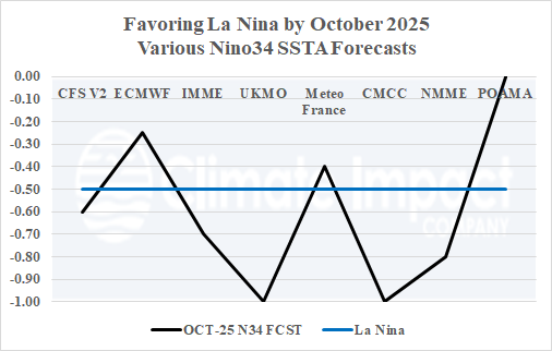
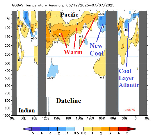
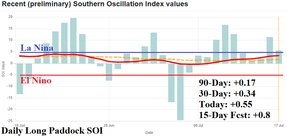
Fig. 1-5: The daily Nino34 and East Pacific SSTA analysis, October Nino34 SSTA forecasts, equatorial upper ocean heat analysis, and daily southern oscillation index.