U.S. AG Belt and Black Sea Region Trend Wetter
03/26/2025, 8:50 am EDT
Great Plains and Eventually Europe/Black Sea Region Drought Risk for Summer 2025
04/06/2025, 3:30 pm EDT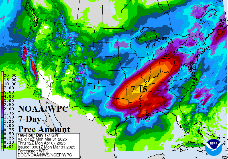
Discussion: A week of high impact weather is ahead for the U.S. including severe storms and tornadoes, excessive rain causing flooding, and followed by unseasonably cold air. Yesterday’s severe weather produced nearly 200 hail damage reports across the Mid-south U.S. (Fig. 1). Tornado Watch areas are issued now for the central Gulf of Mexico States. A widening severe weather outbreak is forecast into the East U.S. today (Fig. 2). A new area of severe storms emerges across the Great Plains late tomorrow and evening (Fig. 3) shifting to the Ohio and Tennessee Valley(s) and strengthening on Wednesday (Fig. 4). Severe storms edge eastward on Thursday (Fig. 5). Excessive rain causing flash flooding becomes a major issue this week, beginning on Wednesday from Texarkana to Toledo (Fig. 6). A repeat is encountered from Texarkana to Dayton on Thursday (Fig. 7) and Dallas to Cincinnati on Friday (Fig. 8). The NOAA/WPC 7-day quantitative precipitation forecast projects 8-15 in. of rain in the excessive rainfall/flood risk stretch (Fig. 9). Following the severe weather and heavy rain an unusually cold snap for April is indicated for the Central and East U.S. (Fig. 10-11).
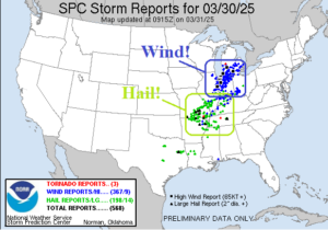
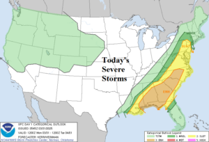
Fig. 1-2: Sunday severe weather reports (so far) and today’s severe weather outlook from NOAA/SPC.
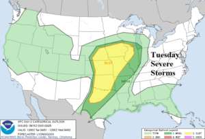
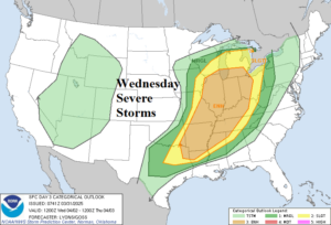
Fig. 3-4: Tuesday and Wednesday severe weather outlook from NOAA/SPC.
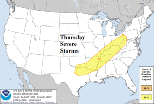
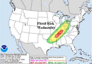
Fig. 5-6: Thursday severe weather outlook from NOAA/SPC and the excessive rainfall/flood risk forecast for Wednesday from NOAA/WPC.
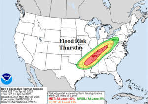
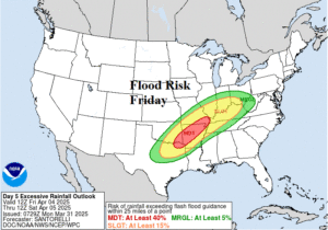
Fig. 7-8: The excessive rainfall/flood risk forecast for Thursday and Friday from NOAA/WPC.

Fig. 9: NOAA/WPC 7-day precipitation amount forecast for the U.S.
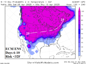
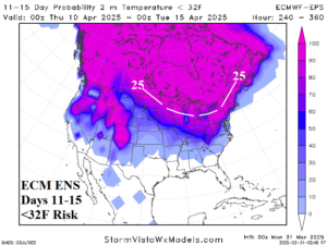
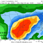
Fig. 10-11: ECM ENS risk of <32F forecast for the medium range.