Equatorial East Pacific Subsurface Cool Waters to Fuel La Nina Diminishing
11/11/2024, 11:18 am ESTECM ENS Continues Highest Skill in Medium-range
11/14/2024, 11:46 am EST

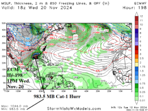
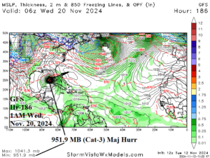
Fig. 1-2: The 12Z GFS and ECM are agreeable to turning a hurricane into southwest Florida during middle of next week.
Discussion: Both the 12Z GFS and ECM project a tropical cyclone generating in the Caribbean Sea later this week, meandering while intensifying for a few days, and turning northwest into the southeast Gulf early next week before a right turn to southwest Florida by middle of next week. Next Wednesday, the GFS indicates a category-3 major hurricane rapidly approaching the southwest Florida Coast (Fig. 1). The ECM is not as strong and slightly farther south (Fig. 2). Both models agree on the southwest Florida hurricane strike. The next storm name is “Sara”. During November, only 3 hurricanes have made landfall on the Florida Coast (Yankee, 1935; Kate, 1985; and Nicole, 2022). The midday 12Z GFS was a little warmer for mid-t0-late November (Table 1).
| HDD EIA End Date | Forecast | 12-Hour Change | 24-Hour Change | 30-Year Normal | 10-Year Normal |
| 11/14 | 99.4 | +0.6 | 0.0 | 121.0 | 119.8 |
| 11/21 | 111.3 | -3.4 | -6.3 | 137.0 | 136.4 |
| 11/28 | 155.6 | -12.3 | +0.6 | 152.9 | 149.3 |
Table 1: The 12Z GFS U.S. gas population weight HDD forecast compared to 12 and 24 hours ago.
