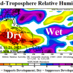
North Atlantic Environment Remains Generally Not Supportive of Significant Tropical Cyclone Activity
07/24/2025, 11:02 am EDT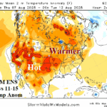
U.S. Cool Break This Weekend/Early Next Week is Brief; More Heat to Follow!
07/28/2025, 8:28 am EDTClimate Impact Company U.S. Sunday Report
Issued: Sunday, July 27, 2025
Highlight: Hottest week of summer 2025; Heat crash mid-to-late week.
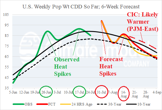
Fig. 1: Observed U.S. population weight CDD for each week of meteorological summer so far and the 6-week forecast.
Discussion: The U.S. population weight CDD forecast reveals the current week as hottest (nationally) of summer 2025 (Fig. 1). Previously, 2 spike hot week regimes were observed ending 6/26 and 7/17. Projected as the 3rd hottest week of summer 2025 is the week ending 8/14. The week 4-6 forecasts are based on analogs closely matching ECM and CFS V2 operational forecast output and have been too cool during the summer season. Preferable is a slightly warmer than normal 10-year forecast for mid-to-late August anticipating anomalous heat and humidity across the high population PJM-East (Northeast U.S. Corridor) sector.
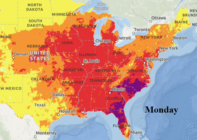
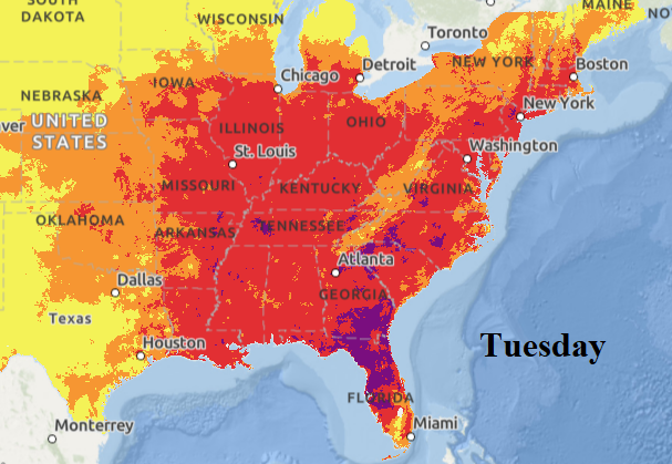
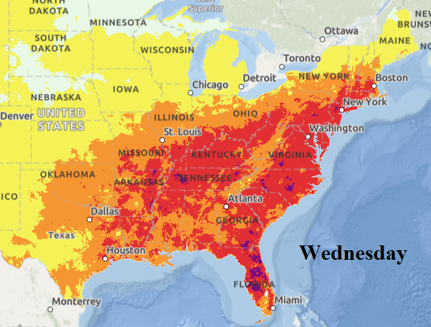
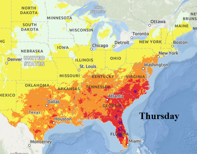
Heat Advisories are posted for much of the eastern half of the U.S. including 29 states of which Excessive Heat Warnings are posted in Nebraska, South Dakota, Minnesota, Wisconsin, and Iowa plus the St. Louis area and eastern Carolinas. Just added (for tomorrow) is southern New England. The NOAA/NWS heat risk forecast projects the heat wave intensity, aerial coverage, and migration through this week. Monday and Tuesday are the hottest days producing highest heat stress (Fig. 2-3) followed by a slow decay of the heat risk (Fig. 4-5) as cold front pushes the heat into the Southeast by Thursday.
![]()
Fig. 2-5: NOAA/NWS heat risk forecast for Monday through Thursday across the East U.S.
Severe thunderstorms, gully-washer heavy rains, and flood risk is continual this week. Today, the Ohio Valley and Mid-Atlantic region is affected by locally heavy rain possibly producing flooding (Fig. 6). The heat follows the rainfall early to middle week. Extreme rain/flood risk is centered on the Western U.S. Corn Belt tomorrow (Fig. 7) and repeats across the western Great Plains Tuesday (Fig. 8). By Wednesday, a powerful cold front focuses severe weather and excessive rain in the central Great Plains/Midwest U.S. (Fig. 9) shifting into the Mid-Atlantic States Thursday.
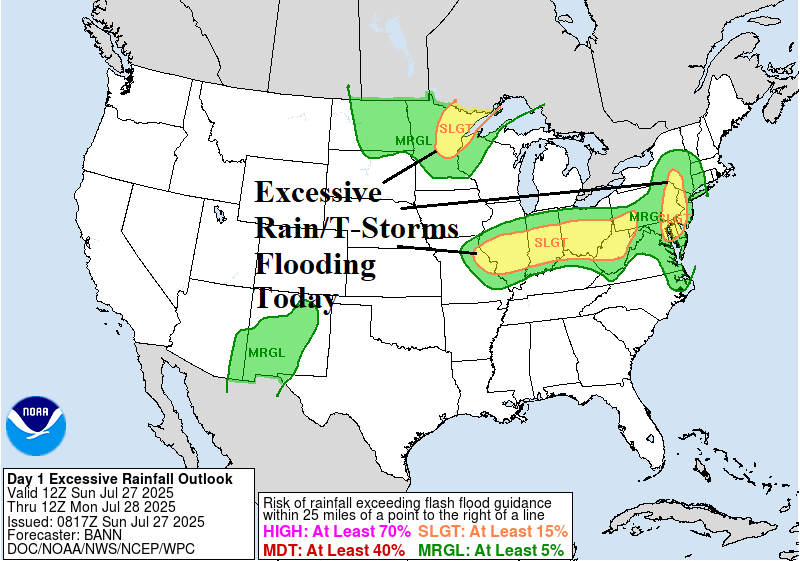
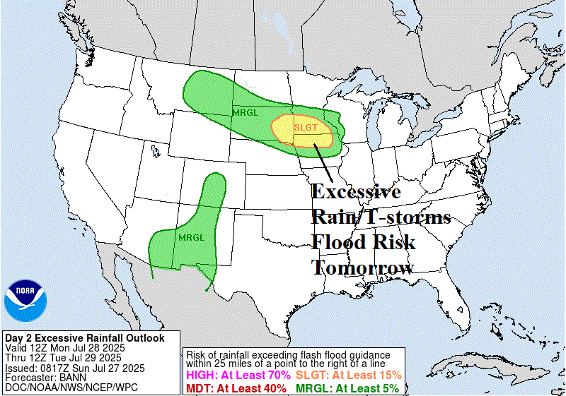
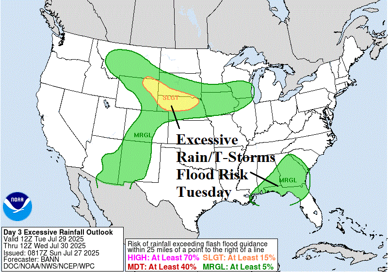
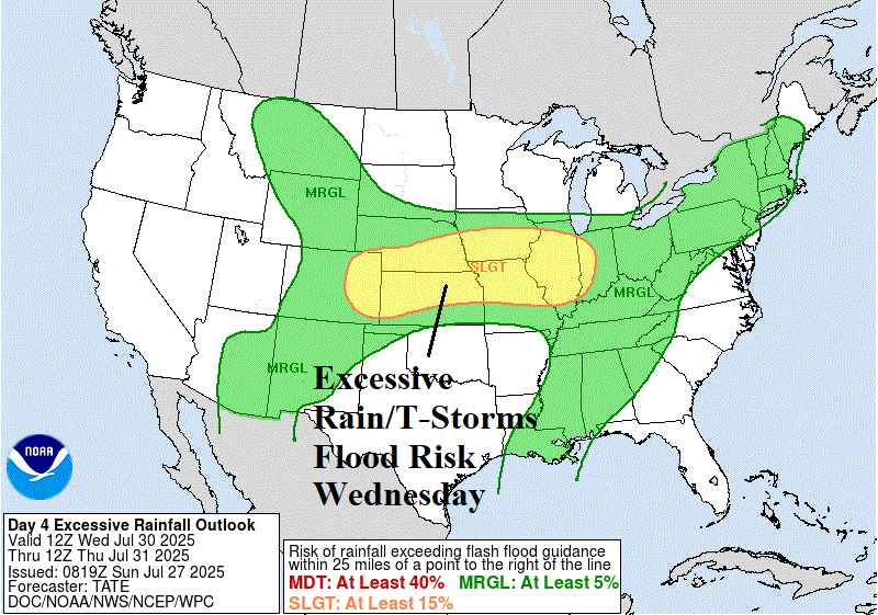
Fig. 6-9: NOAA/WPC excessive rain/flood risk for today through Wednesday.
The tropics remain quiet with no obvious tropical cyclone risk during the next 10 days. The normal number of tropical storm days for July 27 is 7.8 and so far, this season 2.5 is recorded.