Regenerating Argentina Drought in the Summer 2024-25 Outlook
11/21/2024, 8:46 am ESTECM and CFS V2 in Disagreement on 2nd Half of December in U.S.
11/27/2024, 10:38 am EST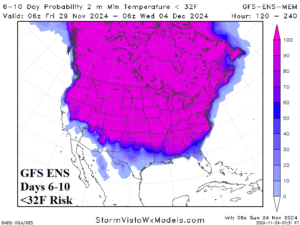
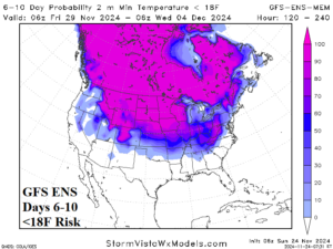


Fig. 1-4: GFS ENS <32F risk and <18F risk for the medium range.
Discussion: The incoming cold pattern east of the U.S. Continental Divide pushes the risk of <32F toward the Gulf Coast with teens across the central and northern Great Plains, the Ohio Valley, and into the Northeast U.S. (Fig. 1-4). During the cold sequence, most notable is the development of south-central to southeast Canada snow cover increasing the effectiveness of the cold air trajectory out of Canada into the U.S.
The midday U.S. medium-range forecasts, as projected by ECM ENS, are colder in the East for days 6-10 compared to outlooks issued late last week (Fig. 5). Again, the snow cover increase in Southern Canada to the Northern U.S. fuels the colder look. ECM ENS is less cold in the East during the 11-15-day period while the West trend is warmer (Fig. 6). The U.S. gas population weight HDD forecast is colder for the first half of December (Fig. 7).
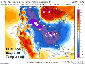
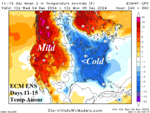
Fig. 5-6: The ECM ENS U.S. medium range temperature anomaly forecast.
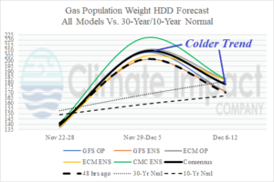
Fig. 7: The U.S. gas population weight HDD forecast utilizing all models, their consensus and comparison with 48 hours ago and the 30-year/10-year normal.
This week, the “atmospheric river” storm track slowly shuts down into California although piling snows extend to the Colorado Rockies much of the week (Fig. 8). The East turns wet on THU/FRI with snowfall covering previously bare ground in Southern Canada into the Northern U.S.
The PJM and SERC Sectors are hit by significant heating demand beginning Nov. 29 lasting through Dec. 5 (Fig. 9-10).
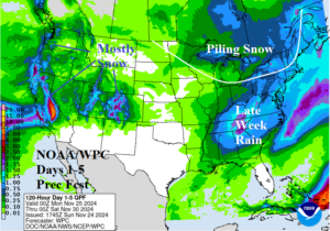
Fig. 8: The NOAA/WPC 5-day quantitative precipitation forecast.
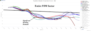
Fig. 9: The latest 15-day PJM System daily temperature average.

Fig. 10: The latest 15-day SERC System daily temperature average.
