U.S. Gas Population Weight HDD Forecast Reveals Warm Winter 2024-25
09/18/2024, 2:50 pm EDTMJO Leads to Spiking GLAAM/GWO! (Associated With North Atlantic TC’s)
09/22/2024, 1:00 pm EDT 


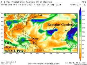
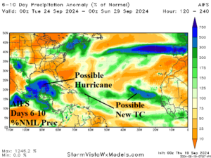
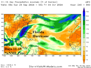
Fig. 1-3: AIFS 15-day percent of normal rainfall across the North Atlantic tropics and subtropics identify tropical cyclone risk.
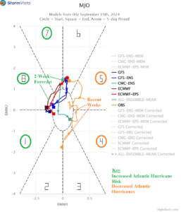
Discussion: AIFS indicates potential for a developing tropical cyclone late in the 1-5-day period in the west-central Caribbean Sea (Fig. 1). In the 6-10-day period, there is the likelihood of a hurricane developing in the Gulf of Mexico (Fig. 2). The hurricane is likely to turn northeastward into the northeastern Gulf of Mexico and the Southeast U.S. early in the 11-15-day period (Fig. 3). Other tropical risks are also indicated in the 15-day outlook. The eastward shift of the convection phase of the Madden Julian oscillation (MJO) to the tropical Atlantic favors increased tropical cyclone risk (Fig. 4).

Fig. 4: The Madden Julian oscillation shifts into a favorable position for North Atlantic tropical cyclone activity.
