U.S. Early Season Heating Demand Spikes Next Week Reverses Much Warmer Late October
10/11/2022, 8:14 am EDT
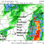
ECMWF Indicates an Atlantic Seaboard Subtropical Storm for Early Next Week
10/18/2022, 10:15 am EDTCharts of the day: 30-day rainfall observations and 10-day rainfall outlook.


Discussion: During the past month much of Brazil has observed a wetter trend and more recently western Argentina has also received significant rain. The dry zone has become constricted to far Northeast Argentina to Uruguay. The GFS 10-day percent of normal rainfall forecast yields a drier trend for Argentina while diminishing the aerial coverage of wet weather in Brazil.
Week-2 Valid October 24-30, 2022: Heavy rains evolve Northeast Argentina.


Discussion: ECM continues to emphasize potential excessive rainfall in Northeast Brazil while dryness evolves and trends stronger for Argentina into Southeast Brazil. Anomalous warmth in Argentina is also stronger.
Week-3 Valid October 31-November 6, 2022: Argentina is drier/somewhat warmer than normal.


Discussion: The wet pattern in Northeast Brazil persists. Argentina dryness and anomalous warmth is stronger.
Week-4 Valid November 7-13, 2022: Stays wet Northeast Brazil.


Discussion: Persistence indicated in the outlook as mid-November approaches…wet weather in Northeast Brazil and mostly dry to the south.
