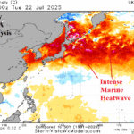
Marine Heatwave Inspires China to Japan Extreme Heat
07/23/2025, 12:38 pm EDT
Hottest Week of Summer 2025
07/27/2025, 11:42 am EDT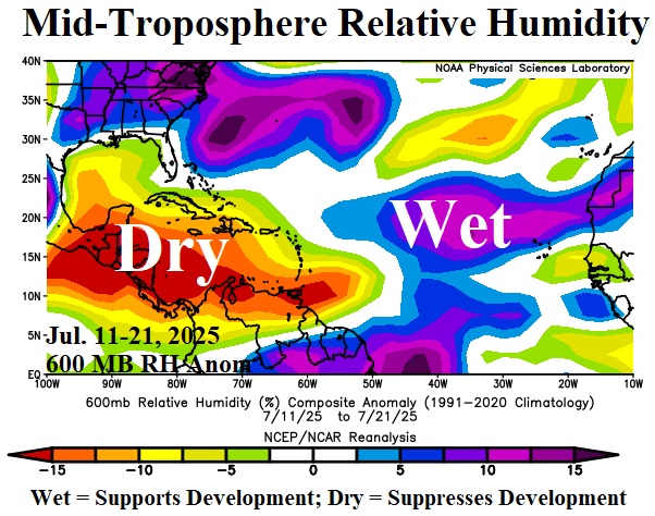

Climate Impact Company North Atlantic Basin 10-Day Monitor
Issued: Thursday July 24, 2025, 9:45AM EDT
Highlight: The current North Atlantic tropical environment. Monitoring Northern Gulf rains.
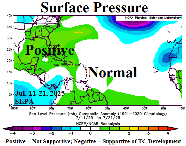
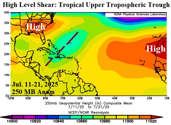
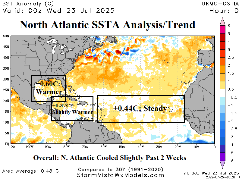
Fig. 1-4: Mid-troposphere relative humidity, sea level pressure anomalies, and 250 MB anomalies for July 11-21, 2025, plus the daily North Atlantic SSTA analysis.
Discussion: Operational model runs from overnight are starting to generate tropical waves in the central and east tropics once we’re into early August. For now, the North Atlantic tropics environment is mostly not supportive of development. The mid-troposphere relative humidity (RH) for the middle third of July 24, 2025, is very dry across the Caribbean Sea into the Gulf of Mexico which is suppressing development (Fig. 1). Sea level pressure anomalies (SLPA) are higher than normal across the northwest Caribbean Sea, Gulf of Mexico, and Bahamas also not supportive of tropical development (Fig. 2). +SLPA is also observed in the deep tropics. Another negative factor is the presence of the tropical upper tropospheric trough (TUTT) since June maintained during the middle third of July (Fig. 3). The TUTT pattern increases upper-level shear. The daily sea surface temperature anomaly (SSTA) analysis reveals each basin is moderately warmer than normal and supportive of tropical development once the atmosphere inhibitors lose intensity (Fig. 4).
A tropical wave is organizing in the northern Gulf of Mexico and shifts westward where a low pressure forms tomorrow in the northwest Gulf of Mexico. ECMWF and AIFS are in good agreement on a 1011-1012 MB low pressure area moving inland along the upper Texas Coast tomorrow evening. The low-pressure area moves across 87-88F water which supports a stronger system than currently forecast. Proximity to land and dry air entrainment from the north attempts to suppress organization. The NBM 72-hour forecast indicates heavy rain offshore (Fig. 5).

Fig. 5: The Gulf of Mexico 72-hour rainfall forecast by the NBM model.