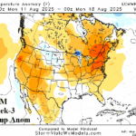
Another Hot Blast for Mid-August in U.S.
07/28/2025, 4:38 pm EDT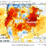
12Z GFS Explodes Hotter Days 11-15 In Northeast U.S.
07/30/2025, 1:28 pm EDT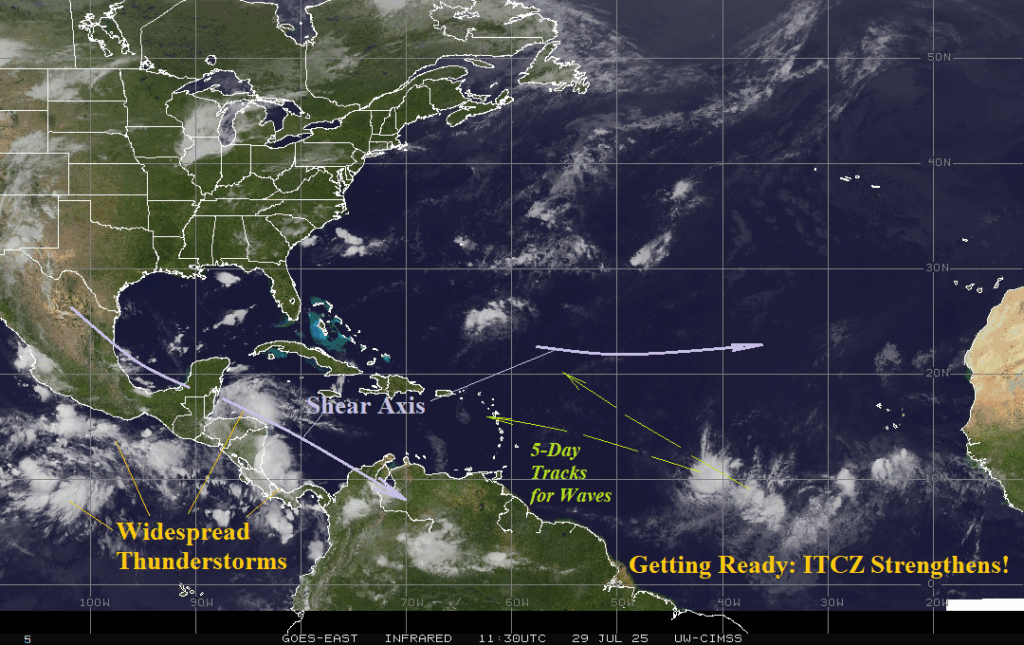

Climate Impact Company North Atlantic Basin 10-Day Monitor
Issued: Tuesday July 29, 2025, 8:15AM EDT
Highlight: North Atlantic ITCZ gaining significant strength!
Fig. 1: North Atlantic basin weather satellite view.
Discussion: The ITCZ in the outer tropical North Atlantic is becoming very impressive (Fig. 1). The beginning of real tropical cyclone season (August 1st) is vividly approaching! Forecast models indicate potential for 2 tropical waves to emerge in the east-central tropics midweek and track west or west to northwest but, due to dry air, unlikely to develop into a tropical system. Thunderstorm activity in the southwest and west Caribbean Sea is unlikely to organize due to proximity to land and an upper shear axis.