Brazil (and Argentina) Rains Continue
10/27/2024, 6:56 am EDTLowering Mississippi River to Receive Beneficial Rains
10/30/2024, 5:23 am EDTDaily IOD Index: -0.57 (less intense)
Daily Nino34: -0.59 (steady)
Charts of the day: Weak La Nina/-IOD rainfall climate in NOV/DEC.
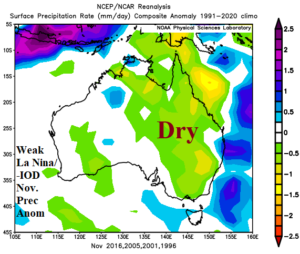
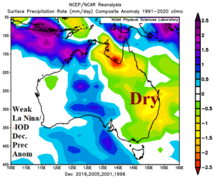
Discussion: Negative Indian Ocean dipole is established. Both Australia Bureau of Meteorology and Climate Impact Company project a short-lived -IOD regime weakening by late 2024. The weekly Nino34 SSTA is -0.5C and the most recent multivariate ENSO index is -0.7, each indicating borderline weak La Nina. During the past 30 years when -IOD and weak La Nina was present, the NOV/DEC precipitation pattern across Australia favored drier than normal climate for eastern sections.
Week-2 Ahead Forecast valid November 3-9, 2024: Eastern heat continues.
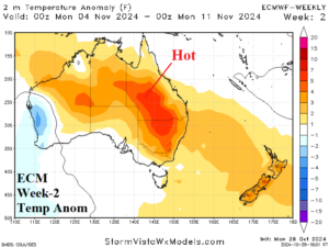
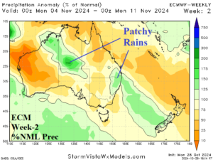
Discussion: The hot weather pattern related to an eastward shift by MJO across the equatorial Pacific toward the tropical Atlantic continues in the East. Patchy and (mostly) lighter rains are indicated.
Week-3 Ahead Forecast valid November 10-16, 2024: Heat lingers; Western Australia may turn wetter.
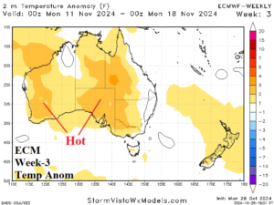
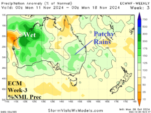
Discussion: MJO shifts back to the equatorial Indian Ocean and may provide the catalyst for some Western Australia wet weather. Ahead of that potential scenario, much of the continent is hotter than normal.
Week-4 Ahead Forecast valid November 17-23, 2024: The outlook is too wet.
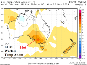
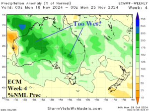
Discussion: ECM “weeklies” are likely too wet. Anomalous heat is forecast beneath subtropical high pressure across Southeast Australia.
