Possible Hotter Mid-August East; More Damaging Wind Midwest. Searing Mid-south heatwave underway!
07/30/2024, 6:06 am EDT
Very Warm Northeast Gulf of Mexico; HWRF Forecasts a Hurricane
08/01/2024, 5:21 pm EDT 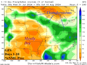
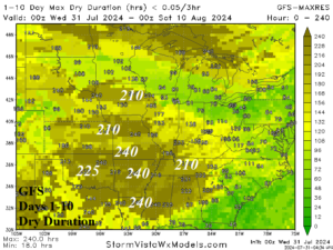
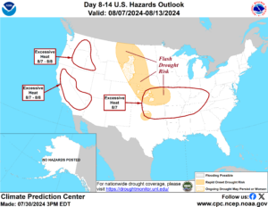
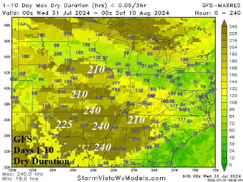
Fig. 1-3: GFS 10-day percent of normal rainfall forecast across the U.S. AG Belt, dry duration forecast for the same region, and NOAA flash drought risk areas.
Discussion: The GFS 10-day percent of normal rainfall forecast indicates dry (and hot) weather continues across the Midwest and Mid-South U.S. (Fig. 1). The GFS dry duration forecast indicates much of the Mid-South U.S. could receive up to 240 hours of no rainfall (Fig. 2). NOAA/CPC indicates flash drought potential across the northwest Great Plains to Kansas during the hot and dry episode (Fig. 3).
Relief is on the way! An amplifying Canadian upper trough pushes a cold front through the drought risk area after 10 days. ECM MAXRES indicates 1-2 in. of rain across the drought core zone (Fig. 4). While the wetter/cooler weather is likely, forecast confidence on rainfall amount is low. A more likely scenario is the developing wet weather associated with the ending of the heatwave is centered on the U.S. Corn Belt rather than the Mid-South States (Fig. 5).
The hot and dry weather across much of the Canadian Prairies will ease during the upcoming pattern change. The 15-day forecast indicates most of the rainfall is across the Southern Prairies (Fig. 6) while the anomalous heat is pushed westward (Fig. 7).
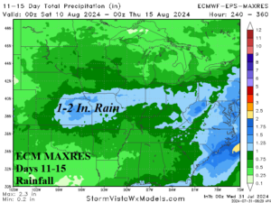
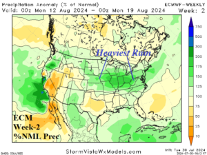
Fig. 4-5: ECM MAXRES forecasts 1-2 in. of rain across Kansas/Missouri in 11-15 days while ECM indicates heavy rain farther north for week-2 ahead.
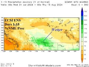
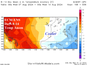
Fig. 6-7: The ECM ENS 15-day percent of normal rainfall and 8-14-day temperature anomaly forecast for the Canadian Prairies.

