Upper Air Pattern Changes: Wetter Argentina
02/07/2025, 9:15 am EST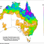
Active Monsoon Soaks Queensland
02/12/2025, 12:06 pm EST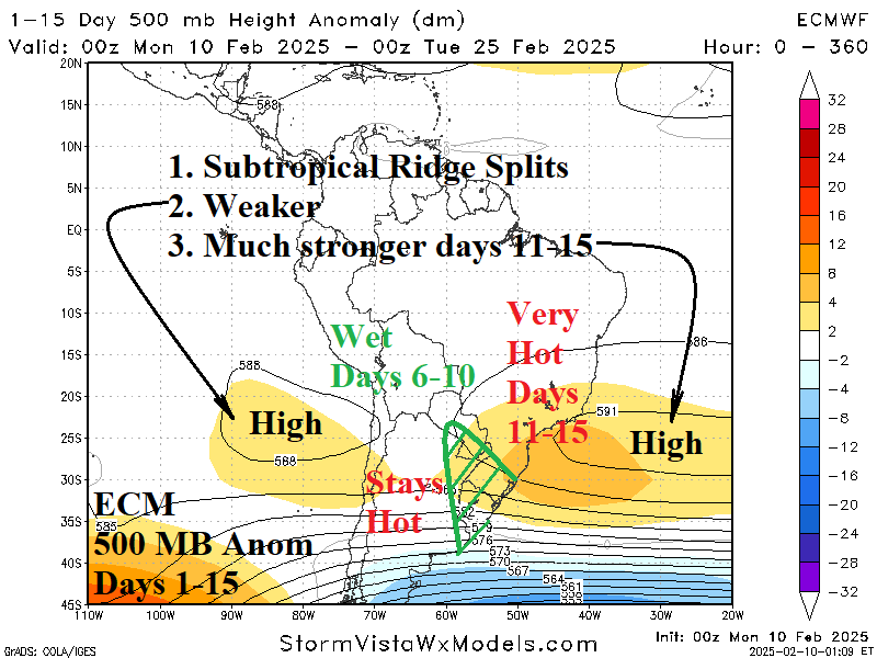
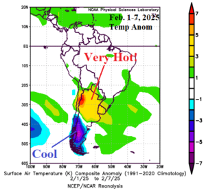
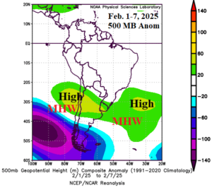
Fig. 1-2: February 1-7, 2025, South America temperature anomalies and attendant 500 MB anomalies.
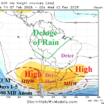
Discussion: Subtropical high pressure anchored over Northern Argentina during early February created excessive heat for the northern half of Argentina to Uruguay (Fig. 1). The subtropical high-pressure area extends from west of Chile to east of Uruguay (Fig. 2) associated with strong marine heat waves (MHW) either side of the central South America coastline. The ECM 500 MB anomalies 15-day forecast indicates the dynamic upper air pattern continues (Fig. 3). The subtropical ridge area splits, returning to home base, across the MHW locations. In-between the split, conditions favoring heavy rain to suppress the intense heat develops in Northeast Argentina/Uruguay centered on the 6-10-day period. ECM strongly amplifies the upper ridge off the southeast coast of Brazil in the 11-15-day period which should inspire vigorous intense heat and dryness in East Brazil in 11-15 days. Meanwhile, the upper ridge west of Chile begins to weaken. In the week 3-4 ahead period, ECM maintains the ridge of high pressure off the central east coast of South America shifting the core southward directly over the MHW (Fig. 4). In this position, a tropical fetch of moisture should invite needed rains into Northern Argentina while the high-pressure ridge maintains hot and dry weather in East Brazil.
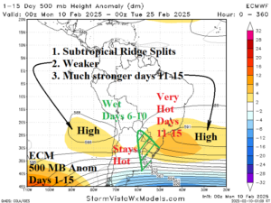
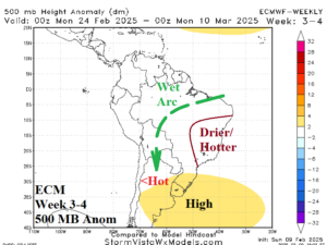
Fig. 3-4: The ECM 500 MB 15-day anomaly forecast and ECM week 3-4 ahead 500 MB anomaly projection.