Evolution of Midwest Heat Projected Extended-range
06/06/2025, 7:20 am EDT
Climate Impact Company Early AG Market ALERT
Issued: Monday June 9, 2025
Highlight: Canadian Prairies and U.S. AG Belt shift wetter. Southwest/South Europe heat (and dryness) while Western Russia is cool/wet.
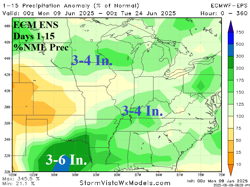
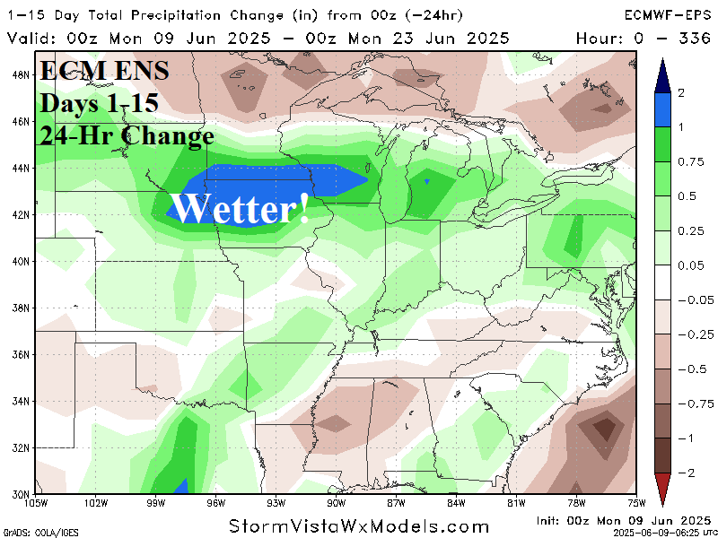
Fig. 1-2: ECM ENS 15-day percent of normal rainfall and 24-hour change across the U.S. AG Belt.
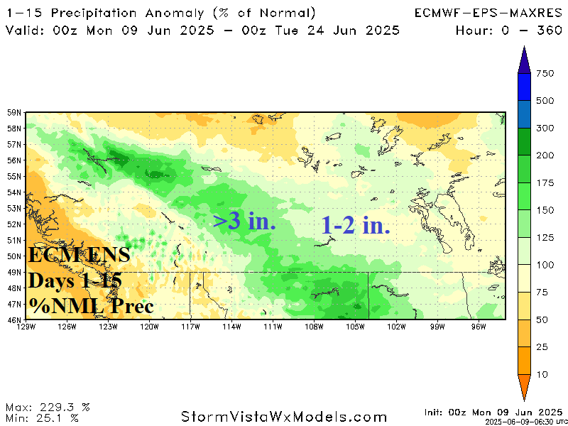
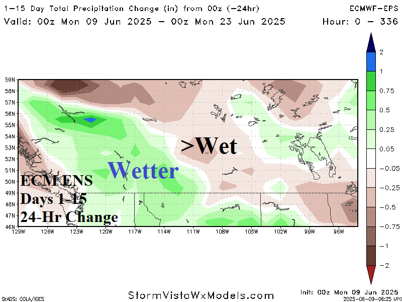
Fig. 3-4: ECM ENS 15-day percent of normal rainfall and 24-hour change across the Canadian Prairies.
Discussion: Beginning yesterday, rainfall forecasts for the U.S. Corn Belt during the medium range shifted wetter. Overnight, the wetter shift continues. In fact, the anticipated eastward shift of West U.S. heat toward (and into) the Midwest U.S. is no longer in the 15-day forecast. The likely contributor to the wetter and cooler change is an active tropical convection pattern in the tropical East Pacific which has an amplifying effect on a Southwest U.S. ridge compensated for by a trough pattern emerging in Hudson Bay and extending south toward the Midwest States. The ECM ENS conservatively forecasts 3-4 in. of rain on the MN/IA border in the latest 15-day outlook with similar amount in Kentucky (and vicinity) with wettest change centered on Iowa (Fig. 1-2). The wetter weather pattern is evident across the Canadian Prairies, especially western sections (Fig. 3-4).
In Europe, a hot forecast trend continues for Spain, France, and eastward to Italy in the latest 15-day outlook (Fig. 5). Maximum temperatures routinely reach 90-95F/32-35C during this time. Meanwhile, Western Russia is cool and wet with Southwest Russia/Ukraine on the southern periphery of this air mass. The hot weather zone is dry and promotes a southward shift of drought potential (Fig. 6). Northern Africa heat and dryness could enhance the Southern Europe early summer hot weather regime!

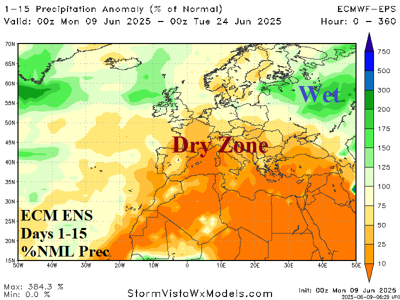
Fig. 5-6: ECM ENS 15-day temperature anomaly and percent of normal rainfall forecast across Europe and Western Russia.