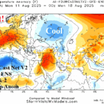
Western Europe Heatwave Ahead!
08/01/2025, 6:07 am EDT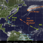
Tropics Getting Interesting! 96L Likely to Develop; ALERTs Posted Caribbean Sea/Central Atlantic Days 6-10
08/07/2025, 9:05 am EDT
Climate Impact Company Weekly ENSO Climate Diagnostics
Issued: Monday August 4, 2025
Highlight: Trend toward La Nina temporarily eases, resumes later August.
Discussion: The southern oscillation index (SOI) has shifted to sharply negative phase during recent days. -SOI emerges when trade winds in the eastern equatorial Pacific ease and the up-welling process which cools surface temperature stops. During the past few weeks, the eastern equatorial surface and subsurface have cooled markedly. The -SOI of early August stops that trend.
The -SOI is generated by an eastward shifting convection phase of the Madden Julian oscillation (MJO) locked in the tropical Pacific for most of meteorological summer. The 2-week forecast indicates the MJO will shift across the tropical North Atlantic to far western Indian Ocean. Once MJO reaches tropical Africa/Indian Ocean, the SOI will reverse to positive phase.
Overall, neutral ENSO remains and the recent cooling trend toward La Nina temporarily slows. Once into the second half of August, +SOI is likely to return. A trend toward La Nina is indicated for Q4/2025. Whether the Nino34 SSTA can shift sufficiently cool and stay consistent to initiate La Nina is in question.
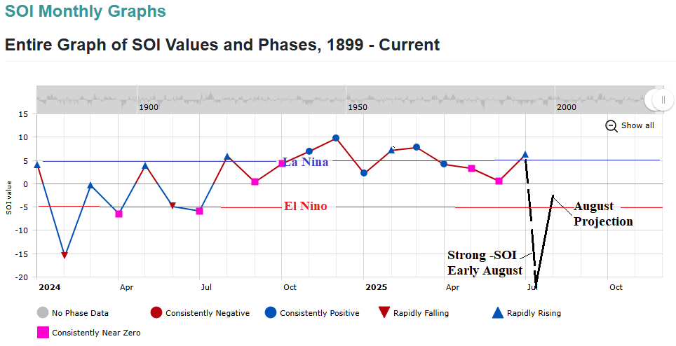
Fig. 1: Southern oscillation has favored a borderline weak La Nina climate although shifting sharply negative in early August.
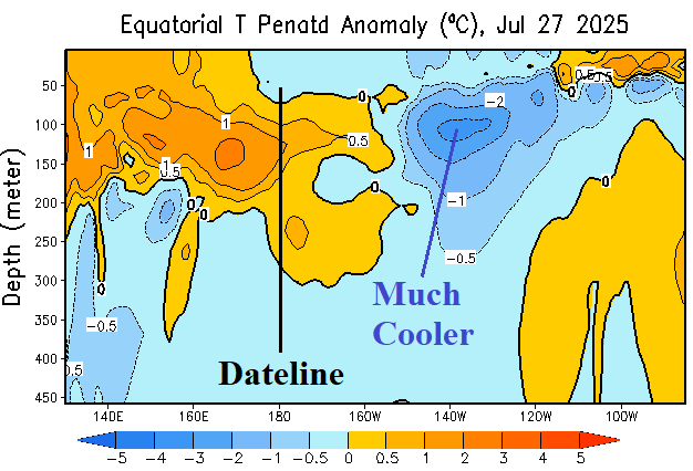
Fig. 2: The upper ocean heat in the equatorial Pacific Ocean east of the Dateline has cooled significantly.
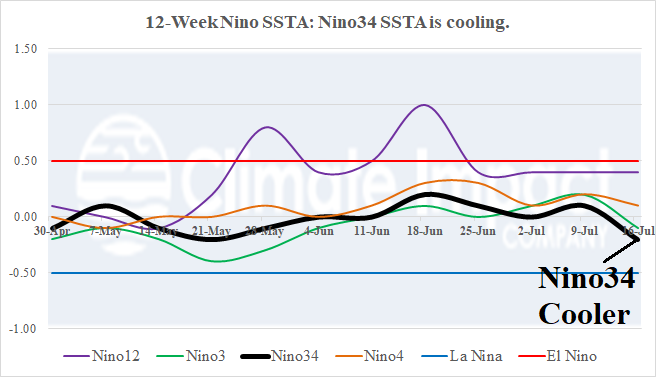
Fig. 3: The 12-week monitor of the Nino SSTA regions indicates a cooler trend for the Nino34 SSTA region.
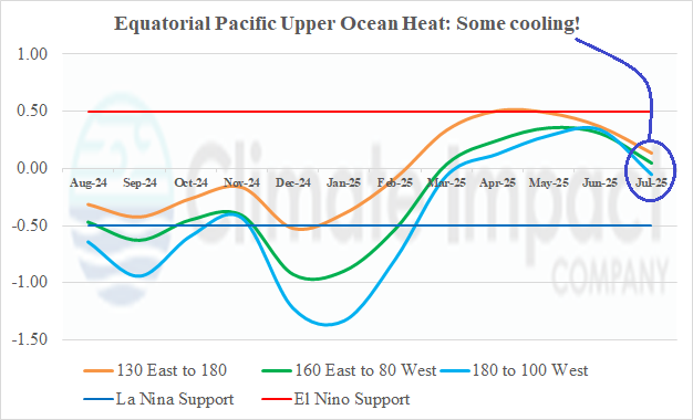
Fig. 4: Upper ocean heat in the equatorial Pacific region has cooled during July.