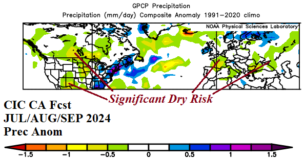
AG Market Weather/Climate Research: Mid-Latitude Ocean Forecast Contributes to a Dry Central U.S. Summertime Climate
03/04/2024, 11:54 am ESTAreas Susceptible for Drought during 2024 Warm Season
03/14/2024, 8:22 am EDT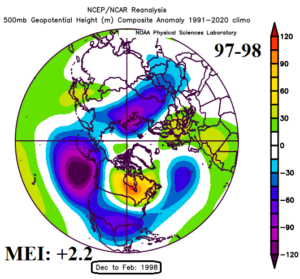
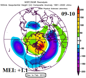
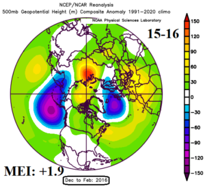
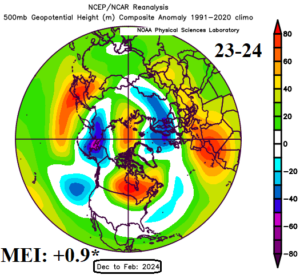
Fig. 1-4: The 500 MB anomaly analysis across the northern hemisphere for the last 3 strong El Nino events compared to the 2023-24 episode. Added for each meteorological winter frame is the multivariate ENSO index.
Discussion: A comparison of northern hemisphere 500 MB height anomalies for DEC/JAN/FEB during the strongest 3 El Nino events of the past 30 years to the just-ended event yields several interesting observations. The general 500 MB anomaly pattern is remarkably consistent but notice how each year produces less and less bold upper trough signatures. Also note that bold troughs during earlier (1997-98/2009-10) El Nino episodes are replaced by bold upper ridge patterns especially with the just-ended winter. Also notice that high pressure in the polar region generally trends stronger. The warming oceans (and attendant rapid rise in CO2) plus the warmer polar oceans/constricting polar ice cap are the catalyst to the warmer 500 MB heights in each subsequent El Nino event. That’s important! The lowering contrast of ocean temperatures in the tropics and poleward diminishes the strength of the El Nino climate as defined by multivariate ENSO index (MEI). The MEI is estimated at +0.9 for winter 2023-24 through January and could be lower once the February value is reported. The opposite is true of La Nina events as the equatorial region cools while the mid-latitude oceans stay historically warmer than normal and thermal gradient increases causing MEI to turn exceptionally negative. Recent La Nina events have become stronger and longer lasting.
