-AO/-NAO Pattern Keeps East Half of U.S. Cold Through February
02/11/2025, 6:58 am EST
Sudden Warming of the Nino12 SSTA Region Affects South America Rainfall Pattern
02/13/2025, 5:19 am EST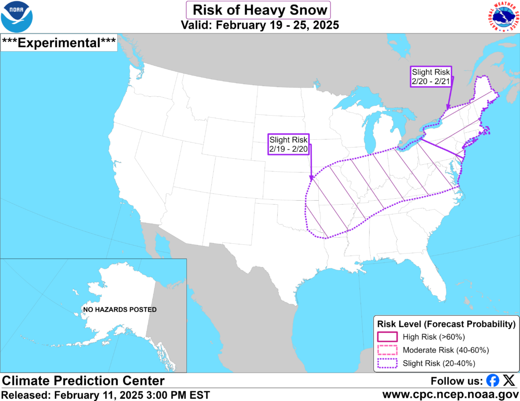
Fig. 1: NOAA/CPC issues an alert for heavy snow risk Feb. 19-21.
Discussion: NOAA/CPC issued an alert for another winter storm producing heavy snow risk from the Mid-south to Mid-Atlantic States February 19-20 and New York/New England February 20-21 (Fig. 1). GFS has this storm with very heavy snow at midday while the ECM is weaker and offshore with the event (sparing New England). There is macro-scale support for the storm and the attendant added snow cover certainly sustains the East chill through the end of the month.
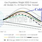
NOAA identified January 2025 as the 33rd coldest and 6th driest on record (Fig. 2-3). The period of record is 130 years in length. The U.S. heating degree count was 2nd highest for January this century due to the cold impact on the high population East U.S. The cold in the East caused a natural gas price spike of 50% higher than the value prior to meteorological winter. The dry mid-winter climate was largely due to the cold upper trough cutting off Gulf of Mexico moisture from the mid-winter pattern. Snowfall was well below normal during mid-winter.
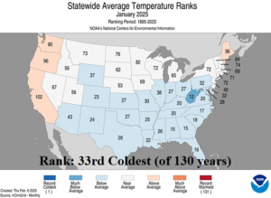
Fig. 2: NOAA identifies January 2025 as the 33rd coldest on record for the U.S. period of record (130 years).
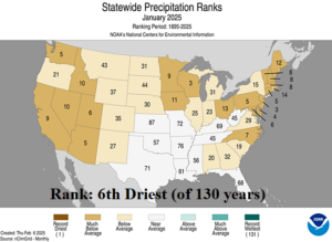
Fig. 3: NOAA identifies January 2025 as the 6th driest on record for the U.S. period of record (130 years).