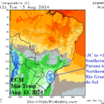
Frost Risk for Southern Brazil Coffee
08/08/2024, 4:36 am EDT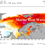
The Norwegian Sea Marine Heatwave
08/13/2024, 8:10 am EDT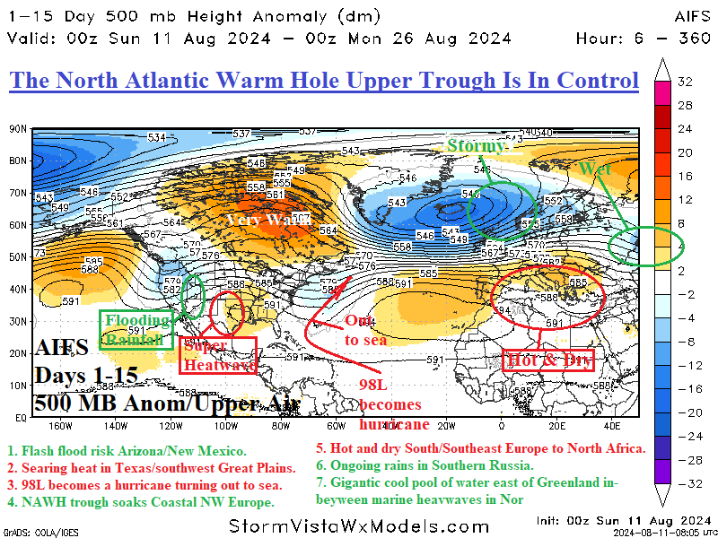
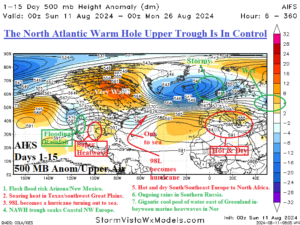
Fig. 1: The AIFS 15-day upper air forecast for North America to Europe and attendant weather hazards.
Discussion: The AIFS prevailing upper air pattern over the next 15 days is driven in large part by the correlation between upper trough and ridge patterns to large areas of cool and warm sea surface temperature anomalies (SSTA). The North Atlantic warm hole (NAWH) named due to its persistent relative cool compared to the surrounding tendency in recent decades of the North Atlantic basin’s warmer than normal character, is alive and well as mid-summer 2024 passes. Consequently, across the NAHW southeast of Greenland, a large upper trough, the most prominent upper-level feature in the 15-day forecast, sweeps storminess into Northwest Europe for much of the next 2 weeks. To compensate for the NAWH trough, a broad upper ridge keeps Canada very warm into late August. South of the Canadian ridge, an upper trough sweeps through the East U.S. and just offshore. Fortunately, this trough will turn Tropical Disturbance 98L, likely a hurricane next weekend, out-to-sea. Trailing that upper trough, a high-pressure ridge causing the searing heat across Texas and the southwest Great Plains. The Texas ridge is amplified ahead of an upper trough rolling into the West U.S. helping to cause gully-washer thunderstorms across Arizona to Utah. In Europe, an upper ridge is upstream from the NAWH trough sustaining hot and dry climate across South and Southeast Europe to North Africa. Downstream from that ridge, a wet trough continues to soak Southern Russia.
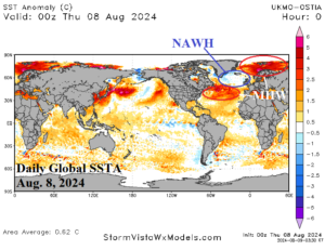
Fig. 2: The daily global SSTA analysis. Note the NAWH pattern southeast of Greenland in-between two marine heat waves southeast of Canada and in the Norwegian Sea.