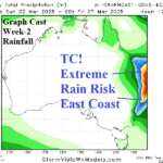
Turning Very Hot in Australia, Tropical Cyclone Risk Queensland Next Week
02/25/2025, 12:35 pm EST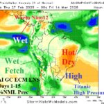
Strong Subtropical High Pressure = Hot/Dry Brazil and Australia
02/27/2025, 8:43 am EST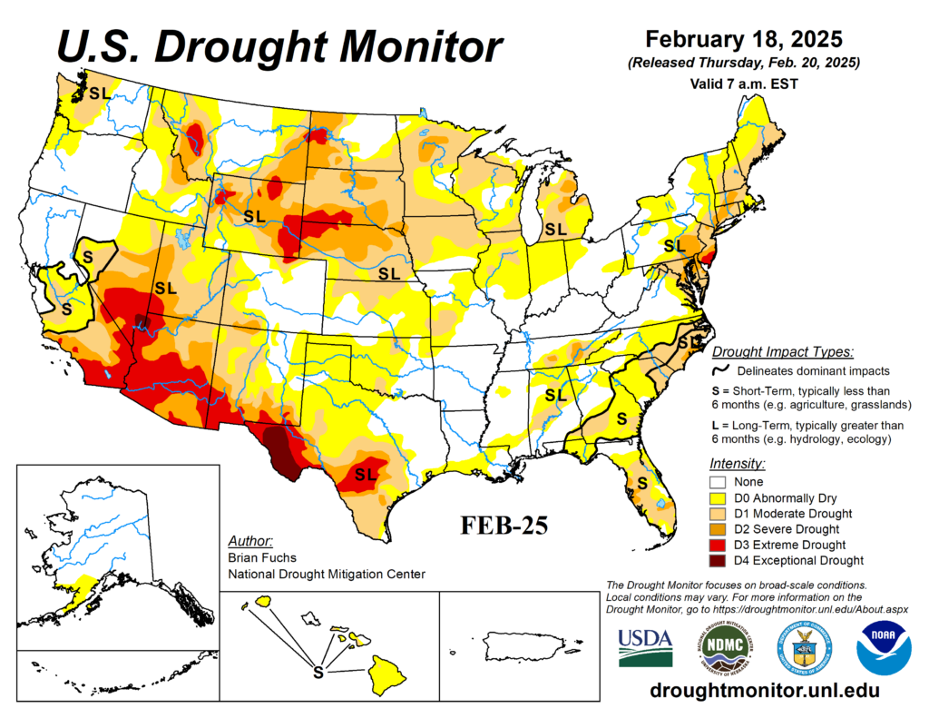

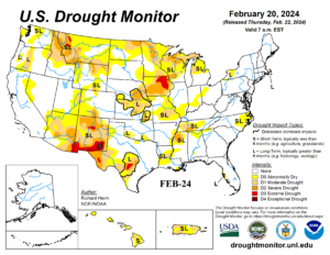
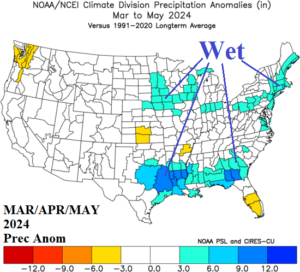
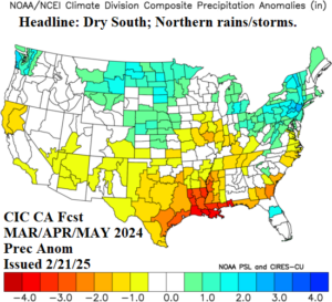
Fig. 1-4: The U.S. Drought Monitor for FEB-25 and FEB-24, the springtime 2024 U.S. precipitation anomalies, and MAR/APR/MAY 2025 rainfall anomaly forecast.
Discussion: The U.S. Drought Monitor reveals larger aerial coverage of drought risk across the U.S. during the onset of the final third of February this year versus 2024 (Fig. 1-2). Last spring, a wet regime erased Midwest dry soil conditions (Fig. 3). This year, the meteorological spring forecast indicates above normal precipitation for the North-central and Northeast U.S. (Fig. 4). ENSO is different this year as weak La Nina is expected to fade through the spring season whereas last year a bold El Nino episode was weakening (Fig. 5). The NMME JUN/JUL/AUG 2025 global SSTA forecast (Fig. 6) reveals the return of an intense cool phase Pacific decadal oscillation (-PDO) and warm phase Atlantic Multi-decadal oscillation (+AMO). Historically, when strong -PDO/+AMO are intact, the U.S. warm season is susceptible to drought across the Southwest U.S., West-central States, and Midwest region (Fig. 7).
Conclusion: Great Plains/Midwest U.S. soil moisture conditions are generally worse than this time last year. Last spring, heavy rain eliminated much of the dry concern. This year, above normal precipitation is forecast in some but not all Central/Midwest U.S. sectors. As ENSO shifts to neutral phase in 1-3 months, the strong warming of the mid-latitude oceans (-PDO/+AMO) yields increasing drought risk for parts of key U.S. crop regions.
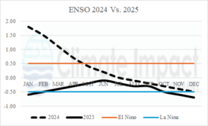
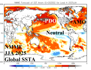
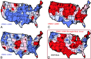
Fig. 5-7: The operational Nino index for 2024 vs. 2025 expectation, NMME global SSTA forecast for JUN/JUL/AUG 2025, and drought risk areas across the U.S. during warm season based on the PDO/AMO regime.