The Dramatic North Atlantic Basin SSTA Regime
05/25/2023, 8:55 am EDTChilly Regimes Increasing a Freeze Risk to the Brazil Coffee-Growing Areas During Mid-Winter Not Tied to ENSO Since 1995
05/30/2023, 3:19 pm EDTHeadline: U.S. Midwest continues to dry-out! Storm track across Southern Europe as -NAO pattern cools EU/Western RU.
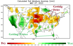
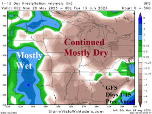
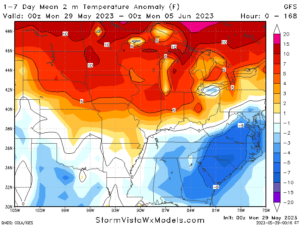
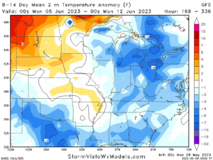
Fig. 1-4: Current U.S. soil moisture anomalies, the 15-day rainfall anomaly outlook, and 1-7-day/8-14-day temperature anomaly outlook (by GFS).
U.S. discussion: Soil moisture anomalies continue to trend drier across the Midwest U.S. (Fig. 1). Strong dryness extends from the central Great Plains to the Mid-Atlantic region. The GFS 15-day rainfall outlook maintains the dryness across most of the areas trending drier during May (Fig. 2). The (new) wet zone is the western portion of the Great Plains drought area. Very warm to borderline hot temperatures visit the Midwest U.S. this week through next weekend (Fig. 3). High temperatures reaching 90F mid-to-late week are likely from Des Moines to Dayton to St. Louis. Air quality may be an issue. However, a somewhat cooler pattern develops for next week across the East U.S. (Fig. 4).
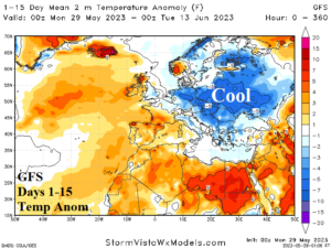
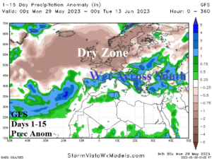
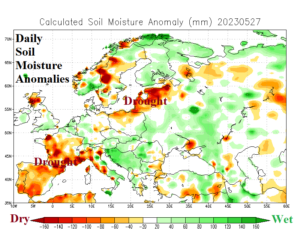
Fig. 5-7: The GFS 15-day temperature and precipitation anomaly forecast across Europe and daily soil moisture analysis.
Europe discussion: Negative North Atlantic oscillation (-NAO) is forecast for much of the next 2 weeks favoring a cooler pattern for Europe into Western Russia (Fig. 5) with significant rain persisting across Southern Europe and reaching the Black Sea region (Fig. 6). North of the wet zone dryness accelerates Baltic States drought (Fig. 7).
Elsewhere: Much of India has observed a wet pattern in May. However, the 15-day forecast is sharply drier (Fig. 8) and trends much hotter. Argentina is dry through the next 10 days (Fig. 9) while Australia is somewhat warmer than normal through the next 15 days (Fig. 10).
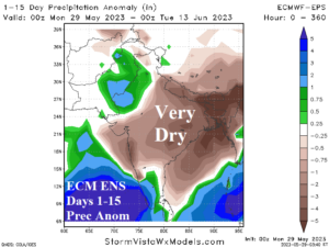
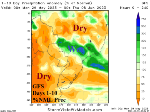
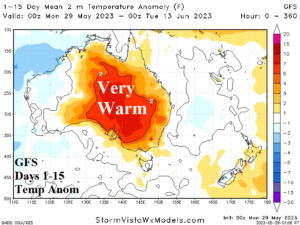
Fig. 8-10: The 15-day precipitation outlook for India, 10-day precipitation outlook for South America, and 15-day temperature anomaly outlook for Australia.
