Europe Week 2-4 Outlook Revised Sharply Milder (and Drier)
01/02/2025, 7:12 pm EST
La Nina BUT Many Ongoing Caveats
01/06/2025, 2:49 pm EST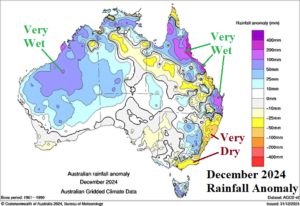
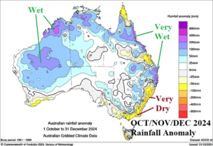
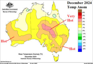
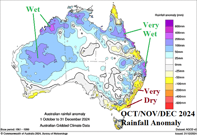
Fig. 1-3: Precent of normal rainfall during December and OCT/NOV/DEC across Australia and the December 2024 temperature anomalies.
Discussion: The Southeast Coastal Region of Australia was very dry in both DEC-24 and OCT/NOV/DEC-24 (Fig. 1-2). Otherwise, precipitation has averaged above normal to excessively wet across many parts of the continent during that time. Helping to aggravate the Coastal Southeast Drought is anomalous warmth during Q4/2024 which became somewhat hotter than normal for East-central and Southeast Australia during DEC-24 (Fig. 3). The anomalous heat accelerated the drying of soil. Consequently, a massive bushfire regime has developed from Victoria to New South Wales.
Some rainfall moves across the Southeast Australia Bushfire Zone during the next 24 hours. According to ECM, rainfall amount for this event is mostly in the 0.25 to 0.75 in. range. The wet weather shifts to the central/south coast of Queensland and most of the New South Wales Coast for the remainder of the week through the weekend. ECM indicates potential for 1-3 in of rain in this stretch for mid-to-late week and next weekend. In the 11-15-day forecast, wet weather lingers on the Australia East Coast much of the time. The ECM 15-day rainfall forecast (Fig. 4) identifies the heavy rain risk on the Southeast Coast (and Northwest Coast). Where heavy rain occurs, the anomalous heat is suppressed. However, areas not receiving rainfall are exceptionally hot through mid-January (Fig. 5).
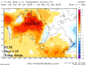
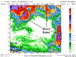
Fig. 4-5: The ECM 15-day temperature anomaly and rainfall amount forecast for Australia.

