Atmospheric El Nino Climate Continues to Lag Oceanic El Nino
07/24/2023, 11:50 am EDTCool Northern U.S. Pattern Change But Will It Last?
07/30/2023, 12:51 pm EDT
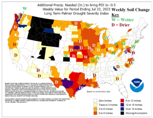
Fig. 1: Rainfall needed to neutralize dry Palmer Drought Severity Index and the weekly change.
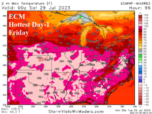
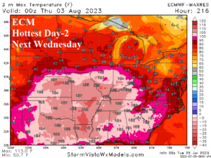
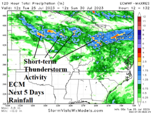
Discussion: This morning, Heat Advisories continue to expand in the Great Plains stretching from Texas to South Dakota (and Montana). An Air Quality Alert spreads across the entire Upper Midwest, Great Lakes, and into the Ohio Valley. Yesterday’s rainfall needed to neutralize dry Palmer Drought Severity Index (PDSI) analysis from NOAA/CPC revealed the Midwest U.S. Drought worsened last week. Exceptions were wetter changes in Northeast Minnesota, Eastern Michigan, and the southwestern Missouri Valley and far eastern Ohio Valley (Fig. 1). The incoming heat will have two peaks reaching the U.S. Corn Belt according to ECM. The first peak is Thursday when 2-meter temperature forecasts reach 100F along the IA/MO state line through central Illinois to the KY/OH border (Fig. 2). A second peak is forecast with lower confidence for next Wednesday and could be hotter for the same region (Fig. 3). Through the next 10 days, the Southern U.S. Corn Belt to the Delta Region is dry while streaks of thunderstorm activity bring marginal beneficial rainfall to the Northern U.S. Corn Belt mostly in the 5-day forecast according to ECM (Fig. 4). Climate Impact Company continues to forecast a break in the heat in the 11-15-day period with a wetter regime developing most-focused on the Southern U.S. Corn Belt and Mid-south States.

Fig. 2: ECM indicates the hottest day this week in U.S. Corn Belt is Friday.

Fig. 3: ECM indicates a second fay of excessive heat reaching the U.S. Corn Belt next Wednesday.

Fig. 4: ECM 126-hour forecast identifies where thunderstorm activity is located.
