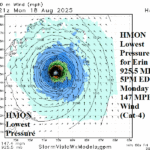
Support (30-31C Water) for Category-4 Major Hurricane Erin East of Bahamas Early Next Week
08/15/2025, 6:06 am EDT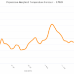
Hottest Event of Summer 2025 in California
08/20/2025, 6:43 am EDT
Climate Impact Company Week 2-to-5 Tropical Outlook
Issued: Tuesday August 19, 2025
Headline: Expecting TC activity each of the next 4 weeks.
Table of the day: 2025 activity so far.
| Tropical Storms | Hurricanes | Intense Hurricanes | ACE Index | |
| 2025 So Far | 5 | 1 | 1 | 26.5 |
| Normal | 4.5 | 1.3 | 0.4 | 18.0 |
Discussion: So far, tropical cyclone activity is near normal thanks to Erin’s influence on early season totals. About 30% of the tropical cyclone season has passed. The Climate Impact Company seasonal forecast indicates the remainder of the season produces 11 tropical storms, 6 hurricanes, and 3 intense hurricanes.
Week-2 Valid August 24-31, 2025: 2 low latitude weaker events.
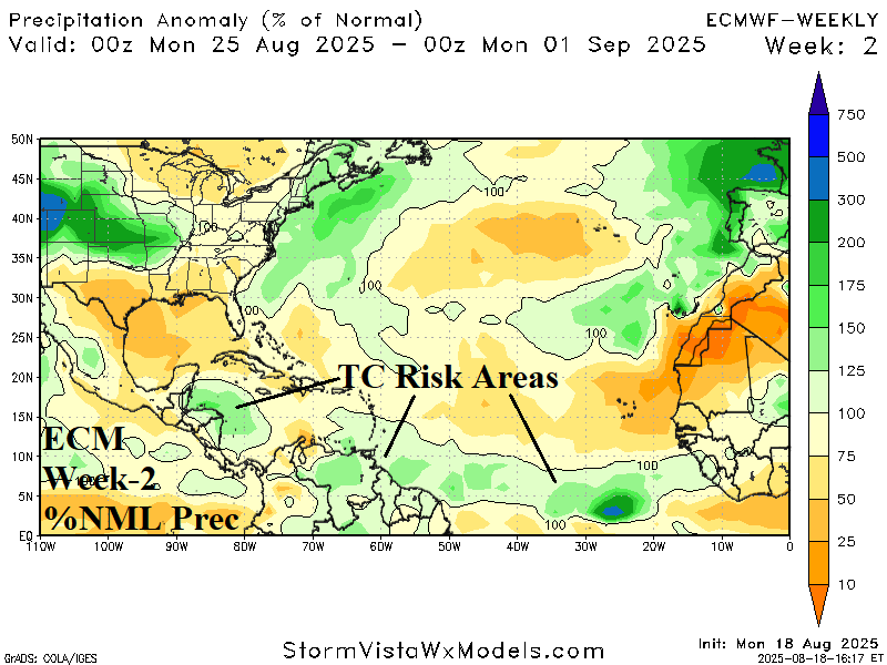
Discussion: Indicated are 2 potential low latitude tracks, across the east and central tropics and in the Southwest Caribbean Sea. A system near or east of the Southeast U.S. Coast travelling northeastward is possible.
Week 3 Valid August 31-September 7, 2025: Two events are possible.
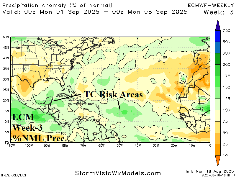
Discussion: Tropical cyclone risk areas are apparent near the Yucatan Peninsula and central North Atlantic tropics during early September.
Week 4 Valid September 7-14, 2025: Possible Gulf of Mexico risk.

Discussion: The week of maximum tropical cyclone risk produces a possible event in the vicinity of the Northern Caribbean Islands and into the Gulf of Mexico.
Week 5 Valid September 14-21, 2025: Significant system possible.
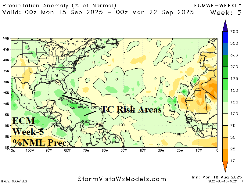
Discussion: Potential for a significant tropical cyclone moving northwestward from the Caribbean Sea to the Gulf of Mexico is indicated.