Update On the Incoming Arctic Air Outbreak for U.S.
01/18/2025, 7:24 am EST
Lengthy Period of Dryness Next Several Weeks Eastern Europe/Western Russia
01/22/2025, 6:02 am EST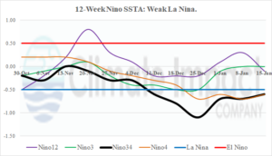
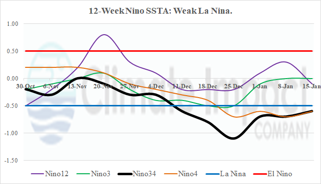
Fig. 1: The 12-week Nino SSTA observations reveal a choppy weak La Nina.
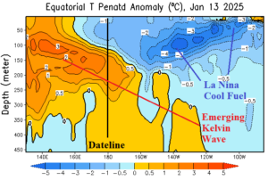
Fig. 2: Contrasting warm West Pacific and cool East Pacific equatorial subsurface.
Discussion: During December, La Nina onset emerged as both the surface and subsurface equatorial East Pacific shifted very cool. However, since that time, a transient Madden Julian oscillation (MJO) weakened the upwelling trade winds across the eastern equatorial Pacific and surface waters have warmed to borderline La Nina conditions in the Nino34 SSTA zone (Fig. 1). In the subsurface, the eastern equatorial East Pacific remains cool although near and west of the Dateline a warm Kelvin Wave is developing (Fig. 2). Successive moderate to strong MJO episodes moving across the Kelvin Wave can encourage eastward movement of the subsurface warm anomaly to weaken and eventually dissipate La Nina. While La Nina onset was recent, we’re now monitoring for the demise of cold ENSO later in Q1/2025 to early Q2/2025.

