Northeast Pacific Marine Heatwave Helping to Propel Western U.S./Canada Heat
07/21/2024, 9:28 am EDT
Subsurface Equatorial Pacific Is Cooling As La Nina Development Has Restarted
07/29/2024, 7:36 pm EDT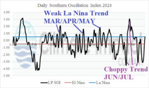
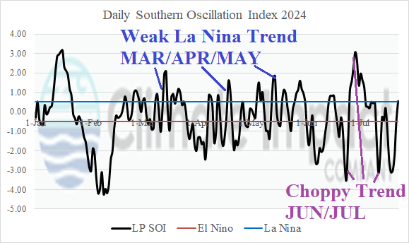
Fig. 1: The daily southern oscillation index observations for 2024.
Discussion: The 2024 daily southern oscillation index (SOI) identifies the uncertainty of direction in ENSO phase (Fig. 1). Recently, SOI has spiked highly negative albeit for brief periods. The negative phase is an indicator of an El Nino climate. Conversely, a strong positive spike occurred late JUN/early JUL which indicates a strong La Nina climate. The recent spikes are a new SOI character compared to weaker daily SOI observations of MAR/APR/MAY 2024.
The 12-week Nino SSTA observations reveal steady neutral ENSO (Fig. 2). Last week, the Nino12 SSTA located off the northwest coast of South America cooled moderately the past 2 weeks.
The subsurface equatorial East Pacific has cooled slightly during the past 7-10 days after the cool anomaly of MAR/APR lost 50% intensity by JUN (Fig. 3). A much cooler signature is required to initiate La Nina.
The latest collection of dynamic and statistical Nino34 SSTA forecasts indicate a range of neutral ENSO to a weak La Nina ahead for later 2024 (Fig. 4). The La Nina is relatively short duration returning to neutral phase by Q2/2025.
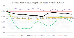
Fig. 2: The Nino SSTA regions indicate steady neutral ENSO.
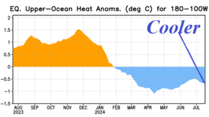
Fig. 3: Upper ocean heat observations for the past 12 months in the equatorial East Pacific.
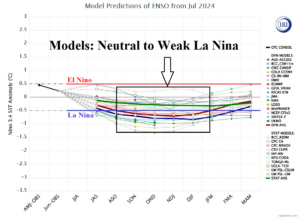
Fig. 4: A collection of all dynamic and statistical Nino34 SSTA forecasts from the International Research Institute for Climate and Society.

