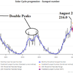
Latest on Solar Cycle 25 Which May Have Ended
04/23/2025, 8:32 am EDT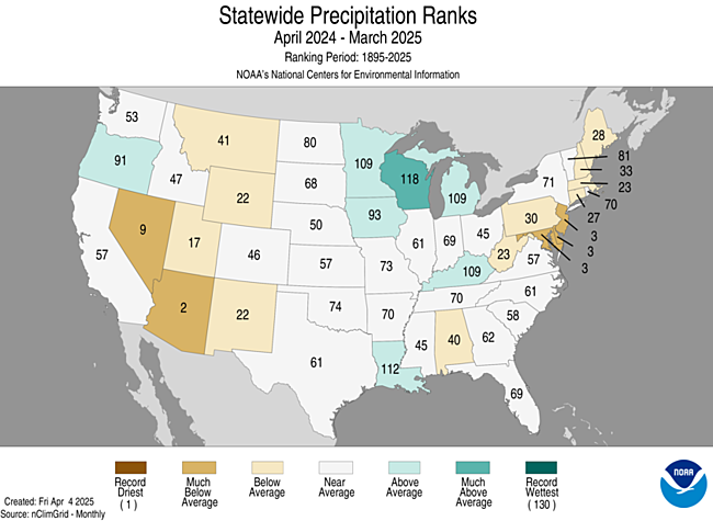
Charts of the day: Long-term U.S. precipitation, where drought is most intense, and “dirty rain”.
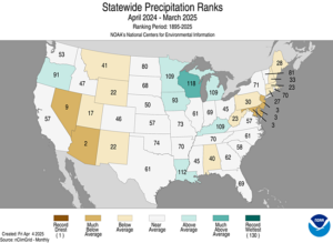
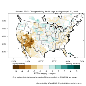
Discussion: The 12-month U.S. precipitation trend is useful to determine what parts of the U.S. have the worst drought condition and potential for additional rapid decline in soil moisture given presence of a dry and warm climate as summer arrives. Clearly, the worst conditions are in Nevada/Arizona and Maryland/Delaware/New Jersey. Arizona has observed their 2nd driest APR-MAR 12-month period on record. The Maryland/Delaware/New Jersey sector has observed their 3rd driest APR-MAR 12-month period on record. The 12-month change in the evaporative drought demand index (EDDI) identifies the bod much drier change across the Southwest U.S. and general drier trend for much of the East Coast to Florida. The large drought across the Southwest U.S. has recently contributed to “dirty rain” events most notable in New England as dust entrained by transient storms is carried 2,000 miles and deposited into the Northeast by passing showers.
Week-2 Ahead Forecast valid May 4-10, 2025: Large area of very warm weather; Needed rain into the Southwest U.S.
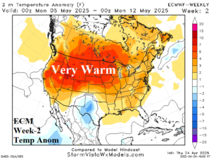
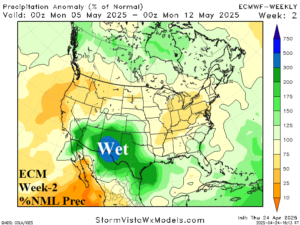
Discussion: An intense upper-level high-pressure ridge is forecast across the northern Great Plains brining significant warming to the Northwest U.S. to the Great Basin northeastward to the Upper Midwest. The warming further south and east by ECM is overstated. Heavy rains shift westward from Texas into the Southwest U.S. drought zone.
Week-3 Ahead Forecast valid May 11-17, 2025: Widespread warmth and drier.
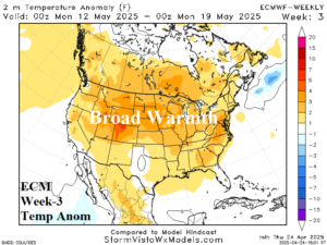
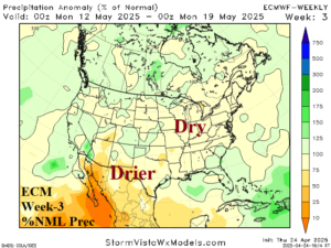
Discussion: ECM maintains the upper ridge although with less amplitude. Combined with mostly dry soil moisture conditions (except the Mid-south U.S.) the model is warmer than normal across much of the U.S. The forecast is much drier although an upper trough could produce wetter than indicated weather across Florida.
Week-4 Ahead Forecast valid May 18-24, 2025: Expect widespread warmth to continue.

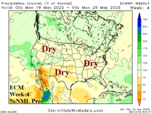
Discussion: The forecast trend is warmer farther north as high pressure is strongest over New England and the West U.S. Wet weather is most likely across the Southeast U.S., wetter than shown by ECM. Additionally, support for wet weather in California as indicated by ECM is weak.