Forecast Change: Models See Arctic Air Western Canada Days 6-10; Ejected Eastward Days 8-14/11-15!
12/27/2024, 7:22 am EST
Heavy Snow and Ice Storm Ahead for Lower Midwest States
01/02/2025, 4:58 am EST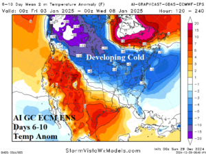
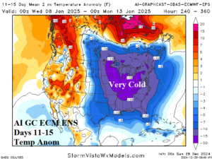
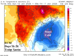
Fig. 1-3: The AI Graph Cast ECM ENS temperature anomaly forecast for North America during the medium range and ECM 16-20-day projection.
Discussion: The cold forecasts for the East U.S. have been indicated by ECMWF for several weeks. However, consistency on intensity and duration was weak. The latest indications are supportive of important and widespread cold with a widening snow cover supportive of maintain the cold as we shift into 2025. The latest U.S. medium range temperature anomaly forecast using AI Graph Cast ECM ENS indicates developing North/Northeast cold in the 6-10-day period (Fig. 1) strengthening and widening in the 11-15-day period (Fig. 2). Not completely understood is whether arctic air can work into the cold air mass or whether the big chill is locally generated by the strength of the upper trough. The ECM “Weeklies” maintain the cold anomalies, strongest in the Southeast to the Carolinas, in the 16-20-day period (Fig. 3).
The position of the cold upper trough dictates the snowstorm threat during the cold pattern. However, models agree on a general expansion of snow cover across the Central and East U.S. by the onset of the middle third of January according to CFS V2 (Fig. 4). The snow cover will sustain the big chill! In the week-3 CFS V2 projection, the snow cover increases across the Interior Northeast (Fig. 5).
The U.S. gas population weight HDD forecast certainly identifies the increasing heating demand. Utilizing all models, the HDD forecast consensus through mid-January is colder than yesterday (Fig. 6) and trend colder for the second half of January into early February according to CFS V2/ECM consensus (Fig. 7). The longer duration cold will occur if snow cover expansion is sustained late in January.
Cold specifics in the U.S. identify MISO, PJM-East, and SERC as hardest hit zones (Fig. 8-10). Around January 10th the Chicago MAX/MIN forecast is 15/0. By January 12th, New York City is a very chilly 28/18. The forecast is cold but not pure arctic air. Atlanta plummets to 36/18 on January 10th. Other key locations such as Richmond and Boston are 32/14 and 28/16 respectively around January 10th.
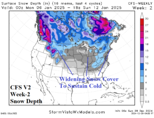
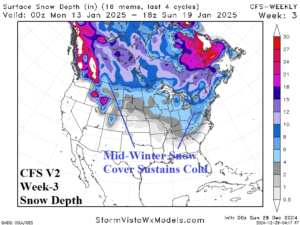
Fig. 4-5: The CFS V2 week-2/week-3 snow depth forecast across North America.
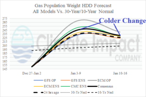
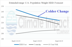
Fig. 6-7: U.S. gas population weight HDD consensus forecast through January and into early February.
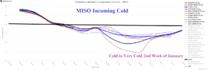
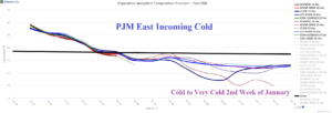
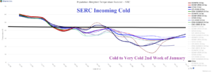
Fig. 8-10: The 16-day system temperature forecast compared to normal for MISO, PJM-East, and SERC.
