Upper Air Pattern Causing Brazil Rains About to Change
11/15/2024, 11:43 am EST
Atmospheric River Brings Life Threating Hazards to Northern California
11/19/2024, 8:15 am EST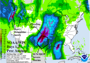
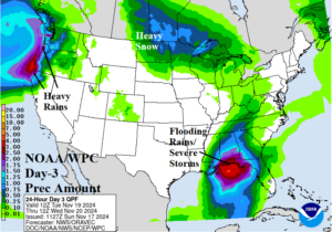
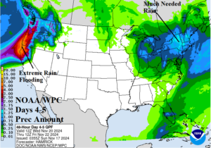
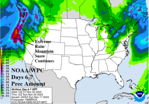
Fig. 1-4: The NOAA/WPC 7-day quantitative precipitation forecast.
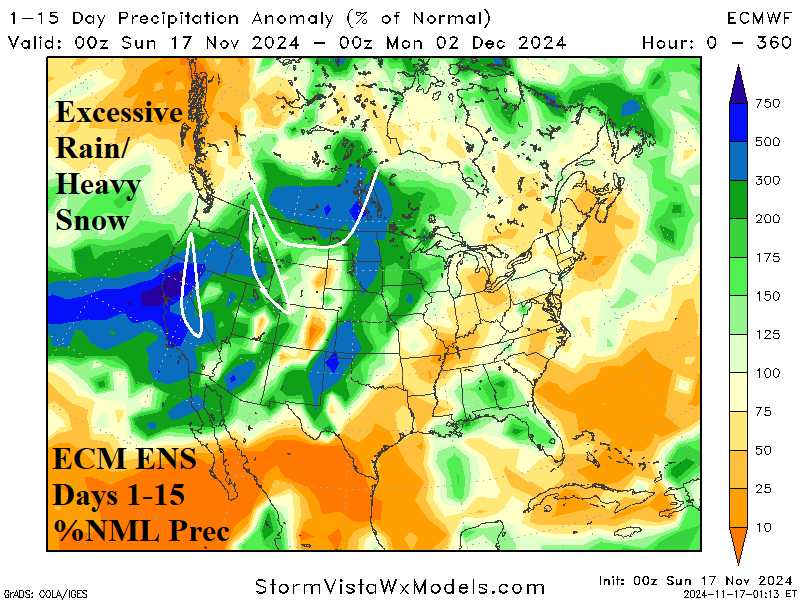
Discussion: A stormy week across the U.S. including the southern Great Plains today, the northeast Gulf States Tuesday, Northeast region later this week, and steadily (with intensity) on the West Coast. Flood Watch areas are posted for the southwest Great Plains for excessive rainfall expected today and tomorrow (Fig. 1). Severe thunderstorms contribute to the heavy rain, centered on Texas and Oklahoma through tomorrow. Meanwhile, high wind, flooding rain, heavy snow watch and warning areas are expansive across the Northwest U.S. On Tuesday, the storminess in the Coastal Northwest is accelerating while the remains of Tropical Cyclone Sara cause flooding rains on the northeast Gulf of Mexico coast (Fig. 2). After midweek, the wet weather shifts across the Northeast U.S. where historical drought is in-place (Fig. 3). Late this week and through next weekend prohibitive precipitation slams the Northwest U.S. Coast including Northern California (Fig. 4). The accelerating storminess on the West Coast later this week is forecast to continue next week, especially in California according to an equal split between the GFS and ECM (Fig. 5). In the 11-15-day period, operational models (at times) and EXCARTA AI project Western Canada arctic air development as meteorological winter arrives (Fig. 6). The U.S. population weight HDD forecast continues to indicate below normal national heating demand trending toward normal once early December arrives (Fig. 7).
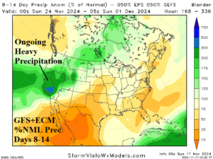
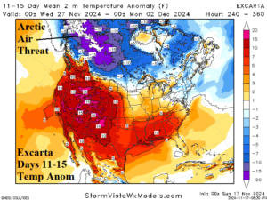
Fig. 5-6: The GFS and ECM 8-14-day percent of normal precipitation forecast plus the 11-15-day EXCARTA temperature anomaly projection.
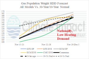
Fig. 7: The U.S. gas population weight HDD forecast utilizing all models, their consensus and comparison with 24 hours ago and the 30-year/10-year normal.

