U.S. Gas Population Weight HDD Forecasts Trending Colder/Longer Duration
12/29/2024, 10:02 am EST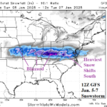
The Ongoing Heavy Snow and Ice Storm for Central and East U.S.
01/05/2025, 3:52 pm EST 
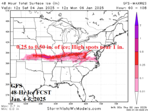
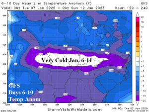
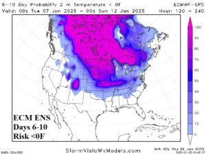
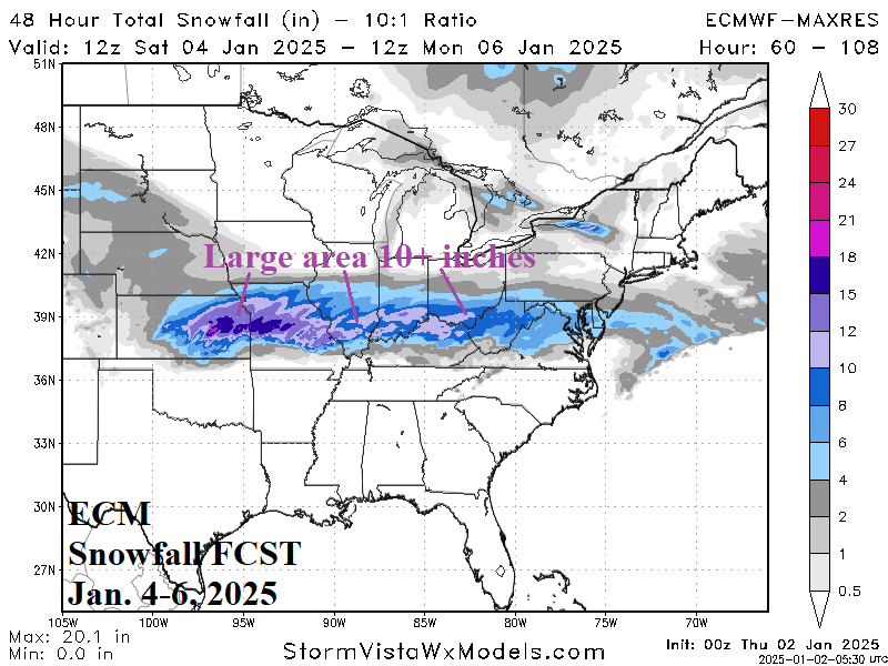
Fig. 1-4: ECM 48-hour snowfall forecast and GFS 48-hour ice forecast for Jan. 4-6, 2025, plus the 6-10-day temperature anomaly forecast by GFS across the East U.S. and ECM ENS risk of <0F projection for the 6-10-day period.
Discussion: A large area of snow develops across the central Great Plains Saturday night extending to the Missouri Valley Sunday morning and across the southern half of the Ohio Valley on Sunday. Snow extends to the Mid-Atlantic States Sunday night and Monday. A large swath of 6-12 in. of snow is likely with high spots in the 12-18 in. range in Missouri (Fig. 1). The cold/warm air clashing causes significant freezing rain and ice accretion. A large zone of 0.25 to 0.50 in. of ice accretion stretches from East Kansas to the southeast Ohio Valley (Fig. 2). After the storm, the snow cover enhances an incoming cold air mass (Fig. 3). Risk of 0F extends to the snow-covered area from East Kansas to South Indiana during the 6-10-day period (Fig. 4).
The U.S. gas population weight HDD forecast for the week beginning tomorrow is not quite as cold as Monday’s outlook although still impressive (Fig. 5). The consensus forecast remains impressive, a colder trend, for the week of January 10-16. The week ending January 23 is also extremely cold based on a consensus between CFS V2 and ECM (Fig. 6). However, ECM trends much warmer to close January than CFS V2.
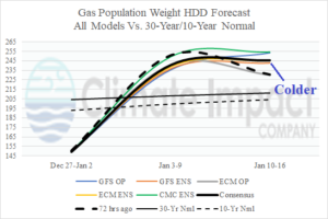
Fig. 5: The U.S. gas population weight HDD forecast utilizing all models, their consensus, and comparison with 72 hours ago plus the 30-year/10-year climatology.
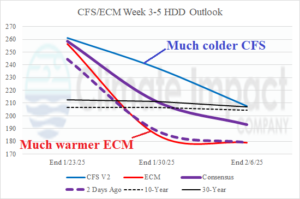
Fig. 6: The CFS V2 and ECM U.S. gas population weight HDD Forecast for 3-5 weeks ahead with the consensus forecast comparison to 24 hours ago.

