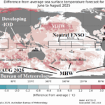
A Look At Australia Bureau of Meteorology JUN/JUL/AUG 2025 Global SSTA Forecast
05/12/2025, 9:16 am EDT
Climate Impact Company Early U.S. Notes
Highlight: Severe storms/flooding rains continue next 2 days; Wet week ahead.
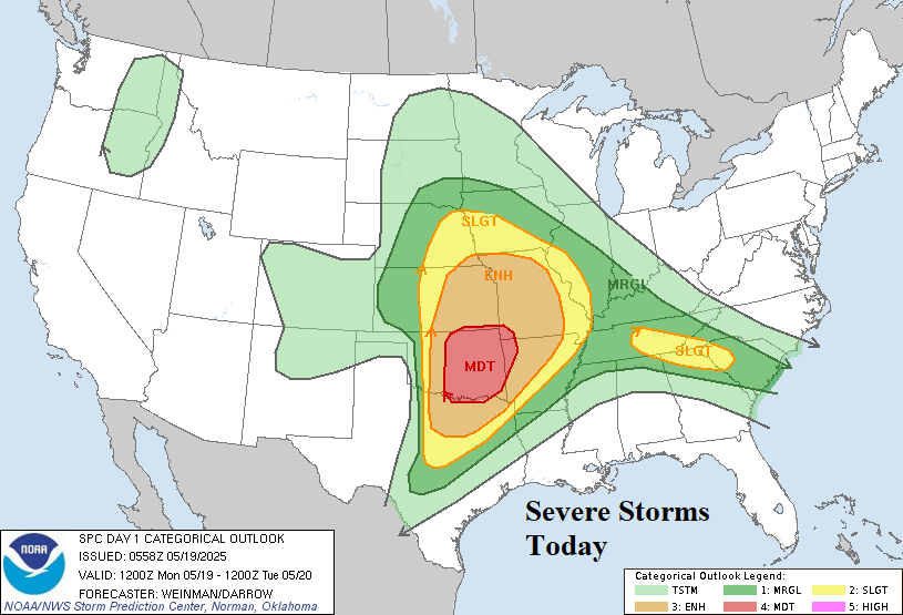
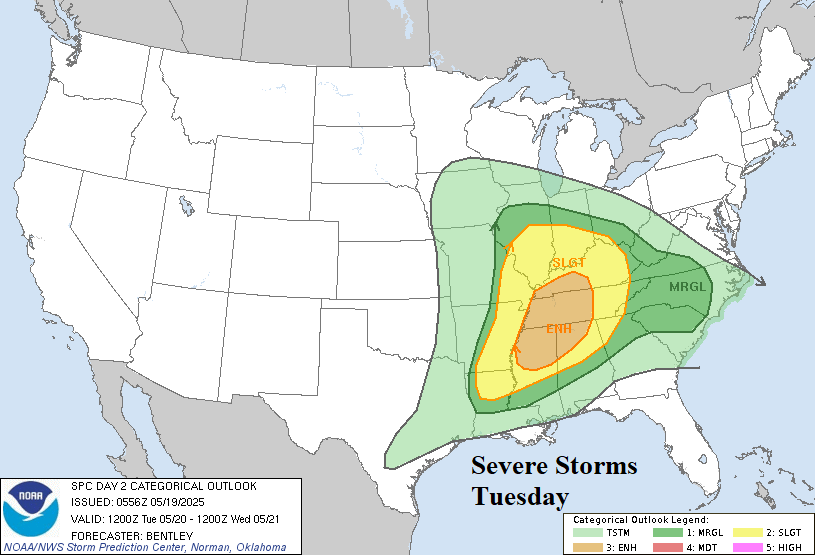
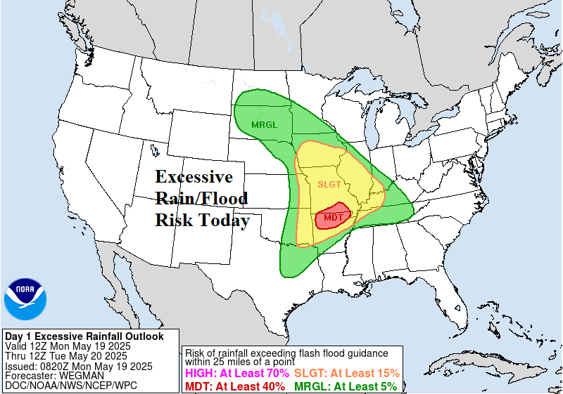
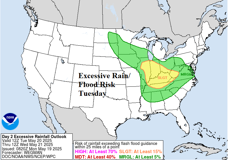
Fig. 1-4: The NOAA/SPC severe weather forecast for the next 2 days and attendant excessive rain/flood risk.
Discussion: Severe weather regenerates in the southeast Great Plains today featuring tornado risk extending from Dallas to Kansas City (Fig. 1). On Tuesday, the severe weather risk area shifts to the East-central U.S. with tornado risk targeting the western Tennessee Valley (Fig. 2). Excessive rainfall producing flash flooding is forecast today for the Missouri Valley and vicinity (Fig. 3) shifting to the Ohio River Valley tomorrow (Fig. 4). The week ahead is wet! Additional heavy rain stretches from the Dakotas to the Mid-south States and eastward into the northern Mid-Atlantic region (Fig. 5). The U.S. population weight HDD forecast indicates much below normal cooling demand to end May (Fig. 6).
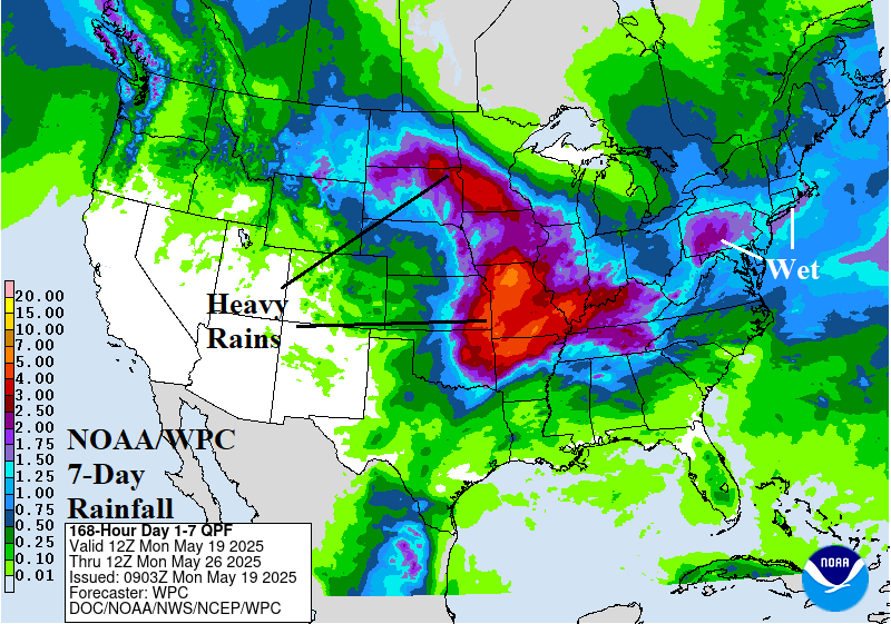
Fig. 5: The U.S. NOAA/WPC 7-day rainfall forecast.
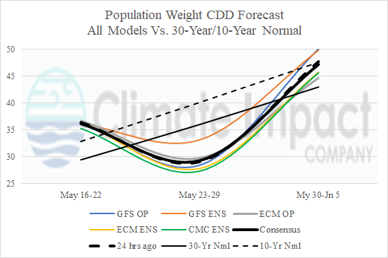
Fig. 6: The U.S. population weight CDD forecast utilizing all models through early June.