Tropical Cyclone Models Develop 95L to a Hurricane
06/27/2024, 9:55 am EDT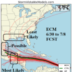
ECM Is Model of Choice, Sweeps Beryl Due Westward!
06/30/2024, 8:40 am EDT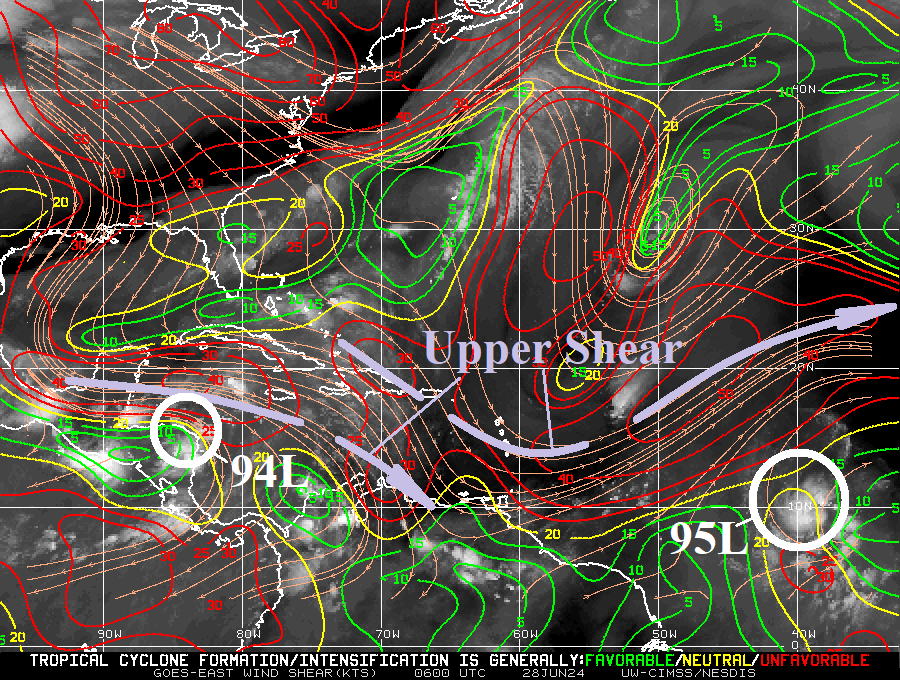
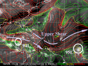
Fig. 1: Upper shear axis across the tropical North Atlantic basin.
Discussion: Identifying the location and intensity of the upper shear axis (Fig. 1) is the first consideration when the tropics turn busy and tropical cyclone models project intensifying events. Of course, Tropical Disturbance 95L is the primary issue. The immediate environment is favorable for development of 95L to a tropical cyclone withing 24-48 hours due to light shear and 83-84F SST. However, a moderate shear axis extends into the Caribbean Sea with a second axis well northwest of 95L. Each shear axis will need to weaken to allow 95L to flourish once approaching the Caribbean Sea.
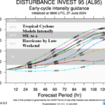
Tropical cyclone models indicate 95L will steadily intensify drifting west and west-northwest reaching south of Hispaniola in 5 days (Fig. 2). The intensity forecasts favor hurricane development in 48-72 hours with risk of a major hurricane once reaching the northern Caribbean Sea (Fig. 3). The track and intensity projection for a late June/early July tropical system in this location is nearly unprecedented.
The 6-10-day forecasts from GFS and ECM indicate two possibilities. A tropical cyclone turning into the eastern Gulf (Fig. 4) or heading due west toward southeast Mexico (Fig. 5).
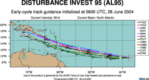
Fig. 2: Tropical cyclone models and their 5-day forecast tracks for 95L.
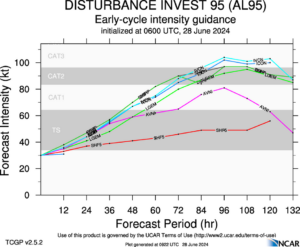
Fig. 3: Tropical cyclone models and their intensity forecasts for 95L.
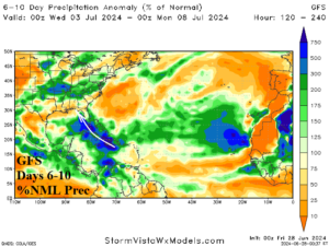
Fig. 4: GFS days 6-10 percent of normal rainfall forecast indicates 95L tracks toward the eastern Gulf.
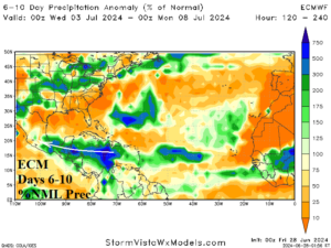
Fig. 5: ECM days 6-10 percent of normal rainfall forecast indicates 95L tracks westward.