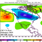
North America Winter 2024-25 Can Expect a “Polar Vortex” in February
08/15/2024, 5:05 am EDTExplaining Lack of Tropical Cyclone Activity; Where SEP/OCT Locates
08/24/2024, 11:46 am EDT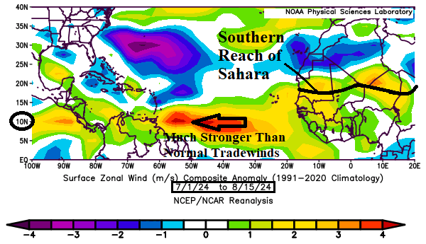
Fast trade winds are the only reason tropical cyclone activity has been held back lower than expected in 2024 so far.
Discussion: Faster than normal trade winds are normally associated with a temperature inversion usually around 850 MB (about 1,500 meters). The temperature inversion prevents vertical motion enabling convective cloud formation associated with developing tropical disturbances. Since July 1st, trade winds have been much faster than normal across the North Atlantic tropics (Fig. 1). The eastward extension of this wind belt reaches across the Southern Sahara Desert which explains why Saharan Dust has also stabilized convective cloud growth across the deep tropics for most of July and August (so far). Of course, aloft the mid troposphere relative humidity is at or below normal in the trade wind belt (Fig. 2). However, not far to the north, mid-troposphere moisture is plentiful. The improved environment for tropical cyclone development in the central/outer North Atlantic is mostly at or just north of the main development region (MDR) for North Atlantic hurricanes. The multivariate ENSO index (MEI) for JUN/JUL was -0.7 implying the global climate has shifted into weak La Nina phase. Typical of La Nina climate during tropical cyclone season, high-level troposphere wind is lighter than normal in the tropics (Fig. 3) and supportive of tropical cyclone development. The North Atlantic basin SSTA remains very warm (+0.84C) although slightly cooler in recent weeks and not quite as warm as last year at this time but certainly very supportive of tropical cyclone development. So far in 2024 according to Colorado State University, 5 tropical storms, 3 hurricanes, and 1 major hurricane have formed. The activity level is slightly above normal but below the average activity for mid-August of the active analog years used to generate the 2024 seasonal forecast. However, what is concerning is the 51.0 ACE index so far compared to 17.0 normal. Beryl, Debby, and Ernesto have each packed a punch and (in my view) characteristic of storms that are ahead of us during the 2024 season.
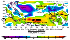
Fig. 1: July 1 to August 15, 2024, surface zonal wind anomalies which identify faster than normal trade winds at 10N latitude.
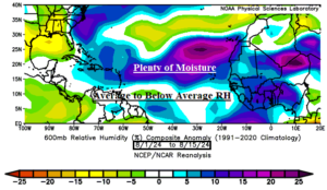
Fig. 2: Above the strong trade winds (in August so far), mid troposphere moisture is near or below normal which suppresses tropical cyclone development.
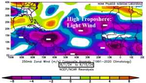
Fig. 3: Zonal wind speed anomalies at 250 MB identify a light wind regime which is supportive of tropical cyclone development.