Strengthening MJO/SOI Causal to Sudden La Nina Trend
08/28/2024, 5:15 am EDTThe SEP/OCT/NOV North Atlantic TC Outlook Versus Normal
08/30/2024, 9:00 am EDTChart of the day: The East/Southeast Europe/Black Sea region drought.
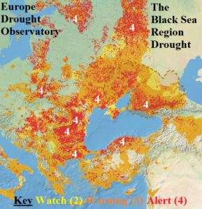
Discussion: ALERT drought conditions are widespread across the Black Sea region and worsening during late summer. Drought is widespread from Southeast Europe to Southwest Russia.
Week-2 Ahead Forecast valid September 8-14, 2024: Southwest Russia heat/dryness continues; Southern Europe is wet.
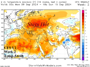
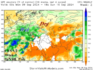
Discussion: The CFS V2 model indicates high pressure sustaining the current heatwave over Ukraine as mid-September approaches. An upper low is on the South France Coast causing heavy rains in South-central/Southeast Europe.
Week-3 Ahead Forecast valid September 15-21, 2024: Some patchy rain into the Black Sea drought area.
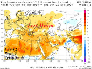
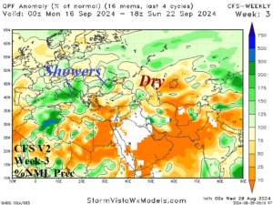
Discussion: The upper trough is eroding. Nevertheless, the CFS V2 model lingers patchy rains across Italy and vicinity and some rain could reach the Black Sea region. The warm intensity is easing.
Week-4 Ahead Forecast valid September 22-28, 2024: Cooler/showery Western Russia; Warmer/drier Western Europe.
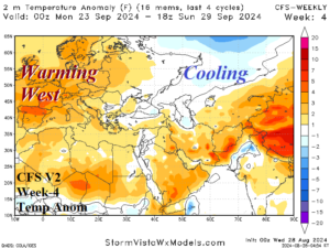
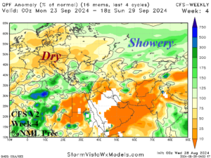
Discussion: The CFS V2 shifts the upper ridge to Western Europe. The low confidence forecast causes a widespread warmer/drier regime for west and central portions of Europe.