More Cold Ahead in U.S. During January but HDD Forecasts Are Warm Into February
01/07/2025, 8:34 am EST
Colder Forecasts in The U.S. Last 1/3 of January
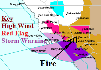
01/09/2025, 9:15 am ESTDiscussion: Based on media reports, the fire began around 11AM in the Santa Monica Mountains. By 5PM Tuesday, more than 1,200 acres burned and hours later authorities reported 2,900 acres were affected. The rapidly spreading fire is propelled by high wind gusting to 100 mph. The Red Flag Warning issued prior to the event was the first since 2021 (for January). The fires stretch from near Santa Monica to near Malibu with the core affected area in Pacific Palisades. A state of emergency is declared for the “fire windstorm”. Fire officials have stated “we are not near the worst of it”.
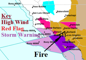
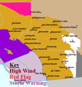
Fig. 1-2: NOAA/NWS weather watch, warning, and advisory areas in Southern California.
The meteorology involved features a low-pressure area over the northern Baja California Peninsula and a high-pressure area over the Great Basin. In-between the 2 pressure systems, easterly (Santa Ana) wind has spread across Southern California with periods of hurricane force gusts. A plethora of high wind and red flag warnings affect Southern California. The meteorological dynamics causing the high wind will ease later tomorrow. However, dry easterlies are like to continue into the weekend. There is no rain in the forecast. Cooler temperatures are expected early next week.

