La Nina Onset Possible by January 1st
12/08/2024, 1:55 pm EST
Strong Asia-Bering Sea-North Atlantic Index Inspires Important Climate/Weather Ahead
12/16/2024, 4:51 am EST 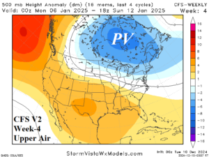

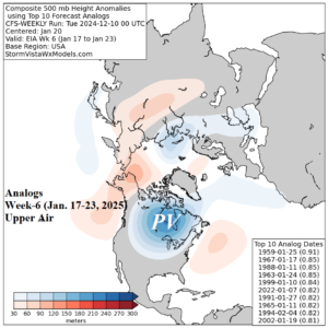
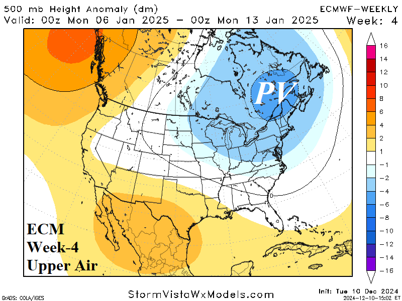
Fig. 1-3: The CFS V2 and ECMWF 500 MB anomaly forecast for week-4 (Jan. 6-12) across North America and the CFS-Weekly Analog output for Jan. 17-23.
Discussion: Stratospheric warming across Eurasia triggers a polar vortex across Northwest Russia later next week. The PV pattern is not particularly intense, and not all models agree on this scenario. Gradually, the PV pattern shifts toward Greenland late this month and into early January.
The western North America upper ridge of late December shifts westward and an Alaska ridge-bridge forms in early January. In response to the ridge-bridge, a downstream polar vortex forms in Eastern Canada agreed upon by both the CFS V2 and ECM (Fig. 1-2).
The forecast trend of the PV pattern for the week of Jan. 6-12 is a little weaker although both models are in better agreement on the position.
The CFS weekly analogs indicate that once the PV pattern arrives, it locks in over Central Canada (Fig. 3).
Implied cold weather risks to the U.S. are certainly present, especially Central and East U.S. given this middle third of January forecast. However, effectiveness of the cold will be reliant on the extent of North America snow cover which is not expected to be greater than normal and to what extent the ridge-bridge over Alaska can tap arctic air in Siberia.

