Drier/Hotter Brazil Weather Pattern Shift
01/10/2025, 5:33 am EST
Projecting Coldest U.S. Gas Population Weight HDD for January This Century
01/14/2025, 5:03 am EST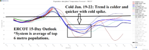
Fig. 1: The ERCOT System 15-day temperature forecast.
Discussion: The weekend trend of the ERCOT 15-day forecast of a repeat cold event is faster and possibly stronger than the just ended (cold) episode (Fig. 1). Interestingly, at 0000 GMT, the most common operational models reveal that ECM is the coldest model while GFS is the warmest.
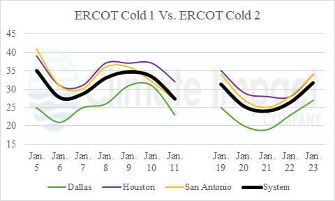
Using ALL models, the forecast consensus of minimum temperature in Dallas, Houston, and San Antonio is near or slightly colder than the just-ended cold regime although shorter in duration (Fig. 2). The coldest morning of the January 19-22 cold spike forecast is colder than the just-ended episode for Dallas, Houston, and San Antonio.
The recent cold was driven in-part by proximity of snow cover prior to onset of the event and snow that fell across parts of ERCOT during the cold event (Fig. 3). The snow cover will retreat/melt this week and there are questions as to whether new snow will regenerate in the southern Great Plains or Texas during the next cold event.
However, what is different about the second cold ERCOT event is presence of stratospheric warming across Canada in the 6-10-day period (Fig. 4) causing an elongated deep and cold long wave trough across central North America which produces the second cold pattern (Fig. 5).

Fig. 2: The observed minimum temperature for Dallas, Houston, and San Antonio for the January 5-11 cold wave and forecast minimum temperature (using a consensus of all models) for a second January 19-23 cold spike.
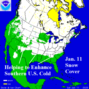
Fig. 3: North America snow cover on January 11 is above normal in the southern latitudes helping to enhance the cold spell.
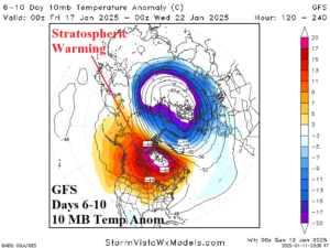
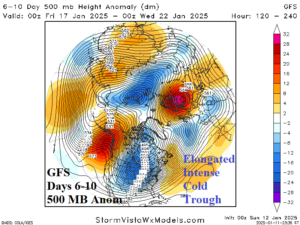
Fig. 4-5: The GFS 6-10-day 10 MB temperature anomaly forecast reveals a stratospheric warming event compensated for by a cold longwave trough in the troposphere recognized at 500 MB.

