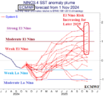
El Nino Risk Appears in 2025 ENSO Forecast
11/07/2024, 7:39 pm EST
Late Season Surge of Northwest Pacific Tropical Cyclones
11/11/2024, 8:52 am EST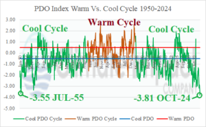
Fig. 1: Monthly PDO index for the 1950-2024 modern-day climate period.
Discussion: The October-2024 Pacific decadal oscillation (PDO) was -3.81, the strongest negative (cool) phase in the 1950-2024 record (Fig. 1). Previously, the strongest monthly value was -3.55 observed in July 1955. The current record-strength -PDO is part of a 5-year cool phase beginning in January 2020. Additionally, the ongoing -PDO regime sustains the cool long-term cycle of PDO which began in the late 1990’s. Interestingly, the current -PDO regime is much different from -PDO patterns of the past. As an example, a strong -PDO was present during October 1999. Not surprising, and typical of -PDO regimes, La Nina was present. During October 1999, the sea surface temperature anomalies (SSTA) across the northeast and east Pacific Ocean were dramatically cooler than normal, typical of -PDO/La Nina regimes (Fig. 2). October 2024 -PDO is considerably stronger. However, the SSTA regime is much different. The Northeast Pacific is generally warmer than normal, including a marine heatwave (MHW) off the California Coast (Fig. 3). However, the SSTA across the Northwest Pacific to the Dateline is record warm. By comparison, the moderately warm Northeast Pacific is much cooler than the record warmth of the Northwest Pacific thus the sharp -PDO. The influence on climate between the two types of -PDO is dramatic. Note that the U.S. precipitation pattern during October 1999 was moderately drier than normal in the Mid-south U.S. region (Fig. 4) while the October 2024 dryness was dramatic for much of the U.S. including driest on record for New Jersey and Delaware (Fig. 5). The “different” -PDO regime was a significant contributor to the second warmest and driest months of October in the 130-year climatology (Fig. 6-7).
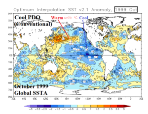
Fig. 2: The global SSTA analysis for October 1999.
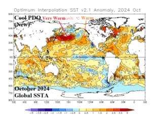
Fig. 3: The global SSTA analysis for October 2024.
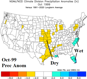
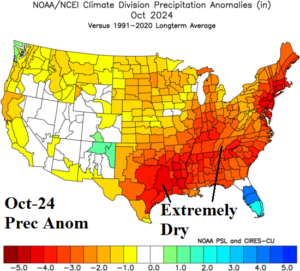
Fig. 4-5: The anomalous precipitation for the U.S. observed in October 1999 and October 2024.
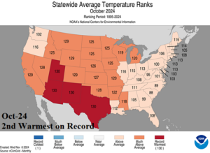
Fig. 6: The NOAA state by state temperature rankings for October 2024.
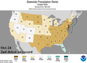
Fig. 7: The NOAA state by state precipitation rankings for October 2024.

