Trouble Brewing In The Western Gulf of Mexico
06/16/2024, 9:14 am EDTDramatic Cooling of the Gulf of Mexico
06/24/2024, 9:14 am EDT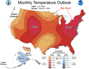
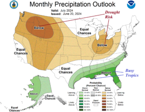
Fig. 1-2: NOAA/CPC temperature and precipitation probability outlook for the U.S. during July 2024.
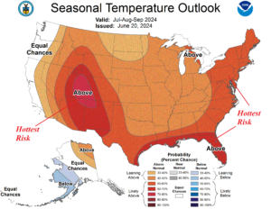
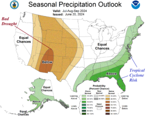
Fig. 3-4: NOAA/CPC temperature and precipitation probability outlook for the U.S. during JUL/AUG/SEP 2024.
Discussion: NOAA/CPC probabilistic climate forecasts indicate several high impact hazards ahead for mid-to-late summer 2024. Most striking is the strong probability of persistent heat across the eastern third of the U.S. and Interior West during July (Fig. 1). The western portion of the eastern hot zone is dry therefore drought emergence risk in the Ohio Valley for mid-summer is likely (Fig. 2). The Interior West is also dry, and the lack of monsoon rains this year will cause persistent extreme heat and an emerging “bad drought” in the Northwest to Southwest States during the next several months (Fig. 3-4). The wet probability centered on Florida and the northeast Gulf Coast in July extending up the East Coast later this summer identifies the most likely coastal zones for tropical cyclone risk. The NOAA/CPC Seasonal Drought Outlook identifies drought expansion in the Northwest and Southwest U.S. plus the southwest Great plains and Ohio Valley (Fig. 5). The autumn 2024 outlook indicates a torrid drought is likely to strengthen across the Southwest U.S. and extend to the central Great Plains and linger Interior Northwest (Fig. 6-7). Autumn 2024 maintains the warm U.S. pattern. The winter 2024-25 outlook features a typical La Nina-biased warm and dry pattern across the South and into the East while the Northwest is stormy (Fig. 8-9).
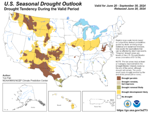
Fig. 5: NOAA/CPC U.S. Seasonal Drought Outlook valid through September.
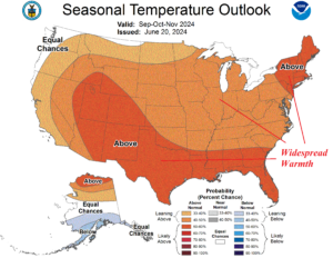
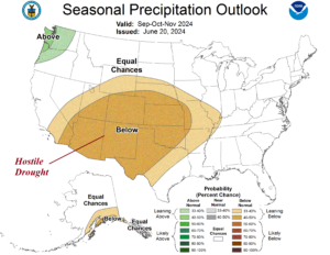
Fig. 6-7: NOAA/CPC temperature and precipitation probability outlook for the U.S. during SEP/OCT/NOV 2024.
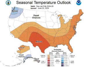
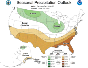
Fig. 8-9: NOAA/CPC temperature and precipitation probability outlook for the U.S. during DEC/JAN/FEB 2024-25.
