Extreme Rain/Severe Weather Event Late Next Week Mid-south U.S.
03/07/2025, 8:51 am EST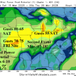
High Wind Event Great Plains to Midwest Late Week and Early Next Week
03/10/2025, 8:28 am EDT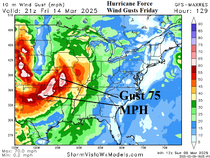
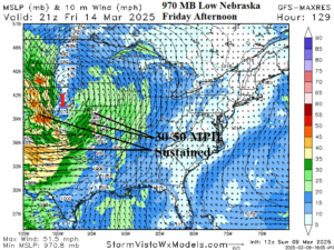
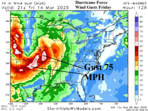
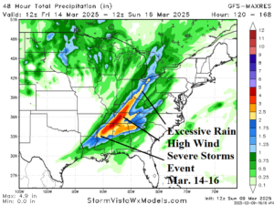
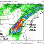
Fig. 1-3: The 12Z GFS projects at 970 MB low pressure across Nebraska next Friday afternoon propelling a large area of 30-50 mph sustained high wind and hurricane force wind gusts in the Great Plains while an unusually intense severe weather event affects the Tennessee Valley and vicinity.
Discussion: An earlier report identified the widening and strengthening stratospheric warming across the polar region. While arctic air generation is locked mostly over Canada, high impact storms are produced across the U.S. Featured next Friday is an unusually low pressure of 970 MB centered on Nebraska. The low pressure causes a large area of extreme wind including sustained wind of 30-50 mph across much of the Great Plains (Fig. 1) with wind gust potential easily exceeding hurricane force (Fig. 2). The high wind profile carries northeastward with the low-pressure system although eventually reaching the East U.S. with less intensity. Additionally, late this week a powerful severe weather episode will develop featuring excessive rain and flooding, high wind, and severe storms including a potential major tornado outbreak centered on the Tennessee Valley and vicinity (Fig. 3). In this stratospheric warming pattern, additional high impact/high windstorms are likely through the middle third of the month.