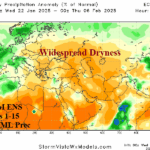
Lengthy Period of Dryness Next Several Weeks Eastern Europe/Western Russia
01/22/2025, 6:02 am EST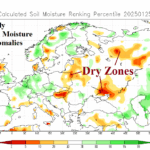
Winter Storm Eowyn Blasts Ireland/U.K.; Dryness Prevails Central Europe/Western Russia
01/27/2025, 5:04 am EST 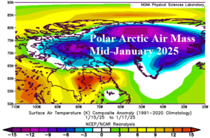
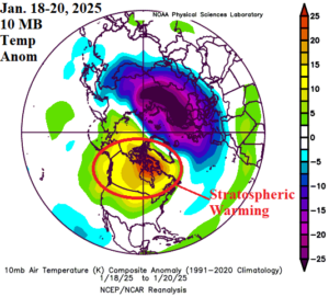
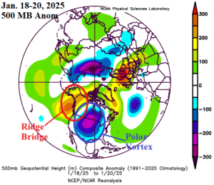
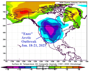
Fig. 1-4: An arctic air mass in the northern latitudes in mid-January, stratospheric warming event that followed and the polar vortex formed by that event, and the attendant arctic air outbreak causing Winter Storm “Enzo”.
Discussion: During mid-January, an arctic air mass formed in Northern Canada and Greenland (Fig. 1). After the arctic air mass formed, a sudden stratospheric warming (SSW) episode emerged over Canada (Fig. 2). The warming and expanding stratosphere quickly compensated for by a cooling troposphere beneath, as a polar vortex formed in central North America (Fig. 3). Upstream from the polar vortex, a “ridge bridge” high pressure area emerged. In between the ridge bridge and polar vortex, north-to-south wind flow pushed the arctic air mass southward beneath the polar vortex, intensifying this weather system. Quickly, a large arctic air mass spread across the U.S. (Fig. 4) with significant snowfall along the southern periphery of the air mass causing Winter Storm “Enzo” to form and extend across the Gulf States. Tropical forcing was also involved as phase_1 and phase_2 of the Madden Julian oscillation (MJO) were present, normally well correlated with U.S. cold climate in January. Additionally, a strong negative global angular momentum (-GLAAM) index was observed identifying the increased tendency of a slowdown in the mid-latitude westerly flow due to emerging deep longwave low-pressure troughs and high-pressure ridge areas.

