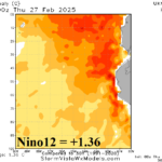
Nino12 SSTA Roars Much Warmer!
02/28/2025, 9:06 am EST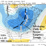
Stratospheric Warming FINALLY Produces Colder Model Run
03/03/2025, 1:04 pm EST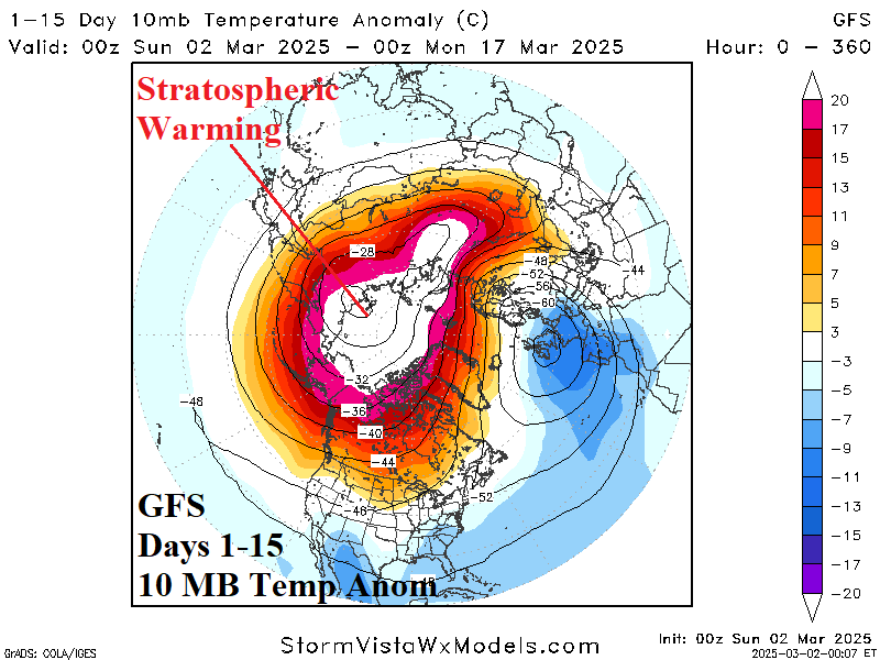
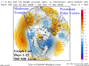
Fig. 1-2: The GFS 15-day 10 MB temperature anomaly forecast identifies location of the stratospheric warming plus the 15-day Graph Cast 500 MB anomaly outlook.
Discussion: Weekend forecasts maintain the stratospheric warming episode unfolding on the Eurasian side of the North Pole in the short-term and gradually extending across the polar region in the 15-day outlook (Fig. 1). The Graph Cast 500 MB anomaly forecast indicates a polar vortex pattern forms on the Northeast Canada Coast with moderate intensity troughs located in Alaska and the West U.S. (Fig. 2). The set-up limits extreme cold risk to the U.S. Pulses of cold are likely with the first affecting the Northeast U.S. today and tomorrow (Fig. 3) followed by a rapid warm-up by midweek (Fig. 4). Another cold burst is forecast for next weekend in the Northeast (Fig. 5) although not as intense as previously expected. Once again, the cold departs quickly with a warm reversal in the Northeast by day-11 (Fig. 6). Quick periods of cold in the Northeast separated by lengthier warm periods are expected during the first half of March.
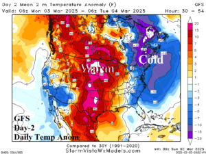

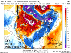
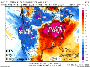
Fig. 3-6: The GFS cold and warm spikes scattered through the next 11 days.