Southwest Europe and Black Sea Heavy Rains
10/10/2024, 4:33 am EDTMuch Needed Rainfall Appears in Great Plains Forecast
10/14/2024, 5:37 am EDTDaily IOD Index: +0.40 ( -0.07 one week ago)
Daily Nino34: -0.57 (-0.38 one week ago)
Chart of the day: Heavy rain potential Southeast Australia ahead.
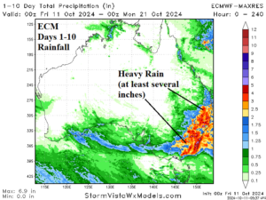
Discussion: Both ECM and AIFS agree that heavy rain evolves across Southeast Australia in the 10-day rainfall forecast. The bulk of the rain is in the 6-10-day period. During that time, a low-pressure area moves southwest to northeast across New South Wales focusing heavy rain along and south of the track.
Week-2 Ahead Forecast valid October 20-26, 2024: Central and northern Australia heat/dryness.
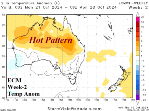
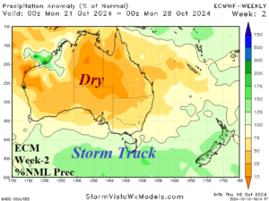
Discussion: An intense storm track rolls across the ocean south of Australia. To the north, a subtropical ridge warms and dries Australia. Hot weather is likely central and northern portions of the continent.
Week-3 Ahead Forecast valid October 27-November 2, 2024: Forecast continues to trend hotter than previously indicated.
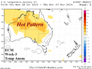
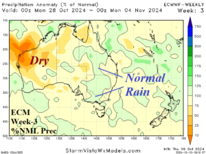
Discussion: Near normal rains appear from central Queensland to central New South Wales. There is no heavy rain risk. Dryness prevails across western continent with near normal rainfall possible on the Southwest Coast. Central and North Australia stay hotter than normal.
Week-4 Ahead Forecast valid November 3-9, 2024: Turning wetter.
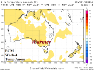
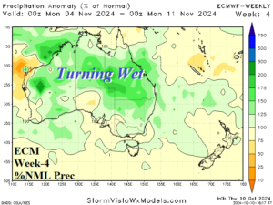
Discussion: MJO influence brings a wetter pattern change for Australia in early November. The previous hot pattern also eases.