
AI Models Gaining Ground on Operational Models
01/30/2025, 5:44 am EST
AI Graph Cast ECM ENS Becoming No. 1 Performing Model across North America in Medium-range
02/02/2025, 12:41 pm EST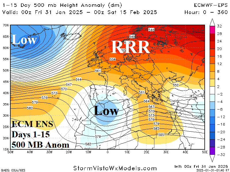
Highlight: The “ridiculously resilient ridge” pattern across Eastern Europe/Western Russia.
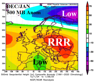
Fig. 1-2: The DEC-24 through JAN-25 location of the Europe “ridiculously resilient ridge” and 15-day forecast by ECM ENS of the RRR pattern shifting north.
Discussion: Most of Europe and certainly Western Russia has observed a warmer than normal winter 2024-25 so far. The exception is France where susceptibility to upper trough(s) have produced anomalous precipitation and chilly temperatures. In fact, despite the presence of a “ridiculously resilient ridge” upper air pattern (Fig. 1-2), and the attendant mild winter regime, Western Europe is wetter than normal so far this winter season. The persistent upper ridge has produced a dry climate over parts of Eastern Europe, the Black Sea region, and Western Russia leading to ongoing and strengthening drought in key agricultural areas. The RRR pattern created a snow drought across all Southwest Russia into Eastern Europe. Causal to the storminess of Western Europe and the downstream dryness and anomalous warmth present during winter 2024-25 so far and forecast to continue into mid-February is the amplified SSTA pattern across the North Atlantic and Mediterranean Sea. Large cool pools of water in the western North Atlantic and near Iceland have attendant strong upper low pressure troughs emitting storms (at times) into Western Europe. Meanwhile, an ongoing record-strength marine heat wave across the Mediterranean Sea including west and southwest of Europe (Fig. 3-4) is well-correlated to the semi-permanent RRR pattern. The pattern described is likely to continue well into 2025 fueling drought concerns for Eastern Europe and Western Russia through summer 2025.
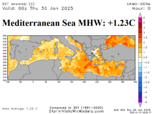
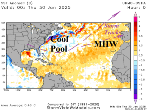
Fig. 3-4: The daily SSTA analysis across the Mediterranean Sea and North Atlantic basin.